Serengeti
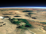
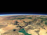
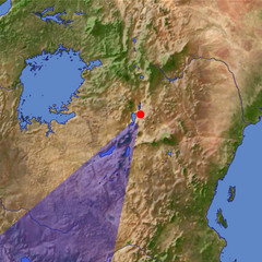
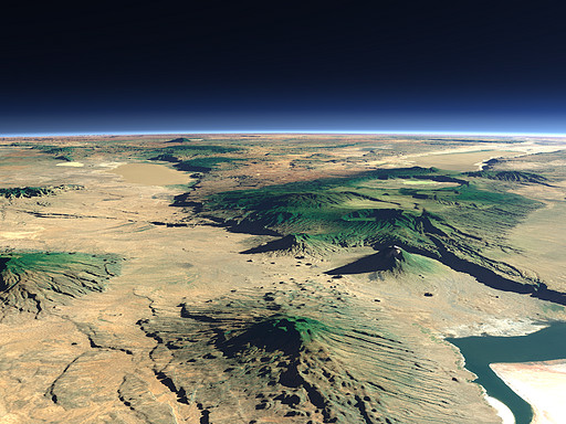
The Serengeti savanna is a region at the border between Kenya and Tanzania famous for its animals. This is a view southward across the Ngorongoro Crater on the right and Lake Manyara on the left.
Ansicht: | Serengeti |
Position: | Lon 36.345° Lat -2.21° |
Höhe: | 19 km |
Richtung: | 210° |
Kamerawinkel: | 38° |
Bewertung: | 2.6 |
Umgebungskarte: Optisch Topographie

Start •
Impressum •
Sitemap •
Bilder:
Liste
/
Karte /
Galerie •
imagico.de • blog.imagico.de • services.imagico.de • earth.imagico.de • photolog.imagico.de

imagico.de • blog.imagico.de • services.imagico.de • earth.imagico.de • photolog.imagico.de
Kommentare:
One concern with this image... it shows the northern part of Tanzania quite well and I can easily identify Ol Doinyo Lengai, Ol Doinyo Gelai, the Rift Valley and the Ngorongoro Crater and Highalnds. However, the Serengeti is further west. It is west of the Ngorongoro Highlands and you ahve shown the area east of the Ngorongoro Highlands, which is the Rift Valley.
Durch das Abschicken Ihres Kommentars stimmen Sie der Datenschutzrichtlinie zu und erlauben, dass die eingegebenen Informationen (mit Ausnahme der eMail-Adresse) in diesem Blog veröffentlicht werden.