Views of the Earth

artificial images of our real planet
The Orange River location map

The Orange River

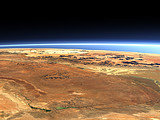
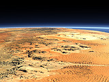
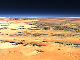
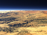
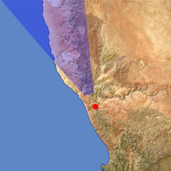
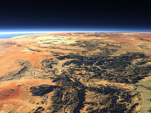
The border between Namibia and South Africa is marked by the Orange River, the only large River at the west coast of Africa south of the Kongo. Behind the Namib desert and on the left the Atlantic Ocean.

View: The Orange River
Location: Lon 17.591°
Lat -29.429°
Altitude: 39 km
Direction: 338°
Camera Angle: 34°
User Rating: 2.4
Location Map:    Visible Topography
The Orange River location map
The Orange River

Related Views:

Central Namibia
The Namib Desert
Roter Kamm meteorite crater
The Fish River Canyon

Visitor comments:

by dallas from United States posted on Mon Dec 11 2006 19:19:12
NICe pic we're the first yippie do da day!
Leave a comment
You have to enable Javascript to be able to write comments.
human verification Please enter the code you can see in the image on the left to verify you are a human and not a spamming script.
* * Required field
Information about you
*
will not be made public
will be displayed with your posting
Your comment (no HTML)

*

If you want to send a private message to the author of this website you can do so via Email.

The comments will be reviewed before they are added to the site. So you might need to wait some time until your entry turns up.

Please note this comment function is intended for commenting on the text and images, not for discussing political or religious views. Comments with no relation to the content of this site will not be approved.

By submitting your comment you agree to the privacy policy and agree to the information you provide (except for the email address) to be published on this website.

  
Design and Content Copyright 2023 by Christoph Hormann
last updated Sun, 16 Jul 2023 20:38