Views of the Earth

artificial images of our real planet
The south end of India location map

The south end of India

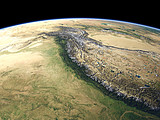
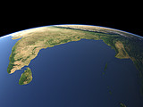
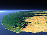
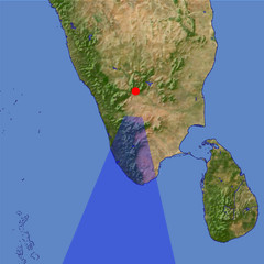
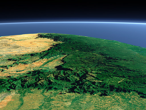
At the southern end of the Indian Peninsula the mountains of the Western Ghats separate the dry east coast of the peninsula from the humid Malabar Coast on the west side. The Anai Mudi (2695m) in the Cardamom Hills, the highest peak in southern India can be seen in the foreground. The humid west coast and mountain parts are famous for the spices grown there.

View: The south end of India
Location: Lon 77.318°
Lat 11.583°
Altitude: 59 km
Direction: 185°
Camera Angle: 36°
User Rating: 2.6
Location Map:    Visible Topography
The south end of India location map
The south end of India

Related Views:

The Himalaya
Bay of Bengal
Kanyakumari/Cape Comorin

Visitor comments:

no comments yet.

Leave a comment
You have to enable Javascript to be able to write comments.
human verification Please enter the code you can see in the image on the left to verify you are a human and not a spamming script.
* * Required field
Information about you
*
will not be made public
will be displayed with your posting
Your comment (no HTML)

*

If you want to send a private message to the author of this website you can do so via Email.

The comments will be reviewed before they are added to the site. So you might need to wait some time until your entry turns up.

Please note this comment function is intended for commenting on the text and images, not for discussing political or religious views. Comments with no relation to the content of this site will not be approved.

By submitting your comment you agree to the privacy policy and agree to the information you provide (except for the email address) to be published on this website.

  
Design and Content Copyright 2023 by Christoph Hormann
last updated Sun, 16 Jul 2023 20:38