Views of the Earth

artificial images of our real planet
The Maoke Mountains location map

The Maoke Mountains

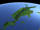
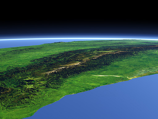
The Maoke Mountain range is the highest mountain range of New Guinea dividing the island from east to west. Its highest peak, the Puncak Jaya (4884m) lies in the middle of this view and is one of the few glaciered peaks in equatorial regions on earth.

View: The Maoke Mountains
Location: Lon 131.947°
Lat -6.054°
Altitude: 149 km
Direction: 70°
Camera Angle: 20°
User Rating: 2.5
Location Map:    Visible Topography
The Maoke Mountains location map
The Maoke Mountains

Related Views:

New Guinea

Visitor comments:

by Lucy from Australia posted on Fri Aug 25 2006 06:07:15
This web's got some good images. \\r\\nbut next time try and add more info into it, or else it's good.\\r\\noh yeah, you will need some close ups on the images as well. so yeah.
Leave a comment
You have to enable Javascript to be able to write comments.
human verification Please enter the code you can see in the image on the left to verify you are a human and not a spamming script.
* * Required field
Information about you
*
will not be made public
will be displayed with your posting
Your comment (no HTML)

*

If you want to send a private message to the author of this website you can do so via Email.

The comments will be reviewed before they are added to the site. So you might need to wait some time until your entry turns up.

Please note this comment function is intended for commenting on the text and images, not for discussing political or religious views. Comments with no relation to the content of this site will not be approved.

By submitting your comment you agree to the privacy policy and agree to the information you provide (except for the email address) to be published on this website.

  
Design and Content Copyright 2023 by Christoph Hormann
last updated Sun, 16 Jul 2023 20:38