August 2014 update on the OpenStreetMap coastline data quality
This is part of a semi-regular collection of reports on the development of the OpenStreetMap coastline data starting with an initial analysis of the quality of the OpenStreetMap coastline data and continuing with updates 1 and 2 and now here with the most recent update on the last half year.
Recent changes in the Openstreetmap coastline
Like previously most updates in the coastline cover only smaller areas and are located in regions of high general mapping activity. Here the subjective list of somewhat larger and more unusual changes since March.
- Improvements of the coast of northwest and south Alaska - not adding much detail but improvement from the PGS data.
- Updates in the southern
 White Sea - like in Alaska not much more detail but still notably better quality.
 - Better coastline in parts of southern Yemen.
- Initial mapping of some features of the
 Cay Sal Bank.
 - Detailed mapping of the
 Ontong Java Atoll (
 here).
 - Retagging of the
 Patos Lagoon as natural=water.
 - Improved mapping of
 Heard Island.
 - Landsat based mapping of the
 Kirov Islands,
 De Long Islands,
 Vize Island and
 Ushakov Island.
The total length of the coastline is now 1.963 million kilometers (again somewhat less than last time). The average node distance is now 60 meters (was 61 in March).
The exclusion of water areas from the coastline
This is the second time there is an decrease in the total coastline length. The primary cause of this is a disturbing trend to exclude coastal water areas from the coastline mapping them separately as natural=water or waterway=riverbank. The coastline then remains essentially as a coarse hull enclosing all land areas and coastal waters and is only partially representing the actual coastline. The fact that nearly all OSM based maps make no distinction between ocean and inland water areas means this change is not visible but it has some very bad effects. Not only does it mean the coastline looses its meaning and any interpretation of the data would always have to interpret both the coastline and the water polygons. It also means there would be no way to distinguish ocean from non-maritime water areas from the data.
In some cases this retagging is based on a broad interpretation of what a river is and where it ends at its mouth. I wrote a proposal on the OSM wiki some time ago that outlines some rules how this limit can be placed in a sensible way. But there are other cases where there is not even a larger river that could warrant tagging costal waters as waterway=riverbank. I observed this particularly at tropical mangrove coasts where tidal channels in shallow water between mangrove areas are frequently tagged as rivers, probably because the form of these channels resembles estuaries elsewhere although the rivers in the area are fairly small. Much of the 'land' area between those channels is tidal mangrove forest and the whole area is dominated by tidal currents and not by waterflow from the rivers. Apart from the mangrove this is not unlike tidal flats at the North Sea coast of Germany and the Netherlands.
Updated quality analysis maps
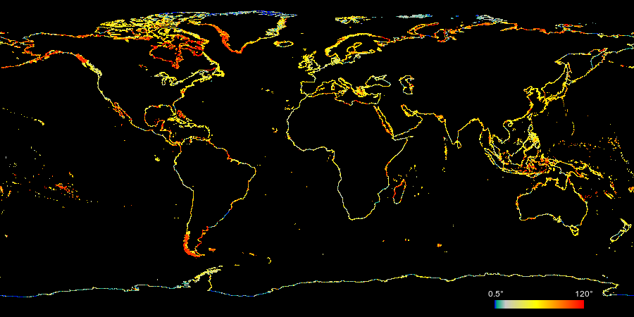
Below are new version of the node distance, derivation angle and combined coastline quality maps. For detailed explanation see the initial coastline quality analysis.
The map of the coastline data age is explained in more detail in the second update.
Christoph Hormann, August 2014


Visitor comments:
By submitting your comment you agree to the privacy policy and agree to the information you provide (except for the email address) to be published on this website.