Imagico.de
Catalog search
Search parameters
Keywords: none specified
Style: special perspective
Minimum available size: arbitrary
Longitude: -180° to 180°, Latitude: -90° to 90°
Purpose: for licensing
Results (?)
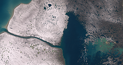
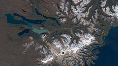
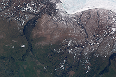
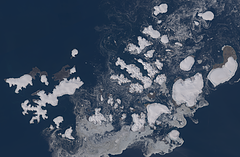
Nettilling Lake in early October 2022
Landsat image of Nettilling Lake in early October 2022 with fresh snow.
| view data | |
|---|---|
| Location: | 71.6° W, 66.6° N |
| Altitude: | 700 km |
| View Direction: | 0° |
| Camera Angle: | 0° |
| Available size: | up to 11166×5956 pixel |
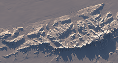
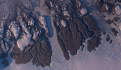
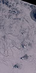
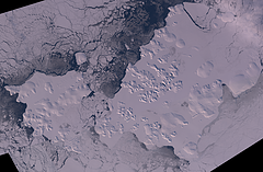
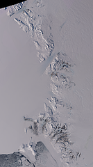
Ellsworth Mountains in late September 2022
Landsat image of the Ellsworth Mountains in late September 2022.
| view data | |
|---|---|
| Location: | 85.74° W, 78.41° S |
| Altitude: | 700 km |
| View Direction: | 0° |
| Camera Angle: | 0° |
| Available size: | up to 8746×4687 pixel |
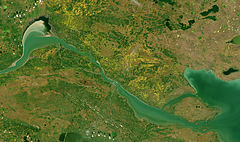
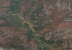
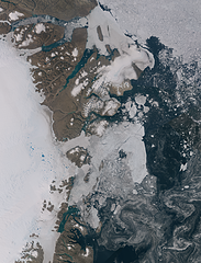
Fort Providence and Mackenzie River in Autumn 2022
Sentinel-2 image of the Mackenzie River near Fort Providence, Northwest Territories, Canada in autumn 2022 with fall colors.
| view data | |
|---|---|
| Location: | 117.55° W, 61.29° N |
| Altitude: | 786 km |
| View Direction: | 0° |
| Camera Angle: | 0° |
| Available size: | up to 12778×7563 pixel |
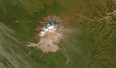
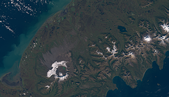
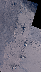
Shiveluch, Kamchatka in Autumn 2022
Sentinel-2 image of the Shiveluch volcano in Kamchatka, Russia in autumn 2022.
| view data | |
|---|---|
| Location: | 161.37° E, 56.66° N |
| Altitude: | 786 km |
| View Direction: | 0° |
| Camera Angle: | 0° |
| Available size: | up to 7443×4406 pixel |
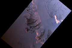
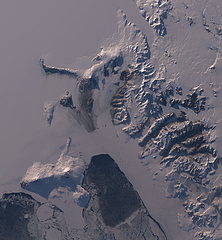
Antarctic sunrise 2021
Landsat image of McMurdo sound and dry valleys in the Antarctic from early September 2021 with very low sun position to the northeast marking the beginning of the 2021/2022 observation season.
| view data | |
|---|---|
| Location: | 162° E, 77.7° S |
| Altitude: | 700 km |
| View Direction: | 0° |
| Camera Angle: | 0° |
| Available size: | up to 25753×17362 pixel |
Mount Katmai and Naknek Lake
Landsat image of Mount Katmai and Naknek Lake on the Alaska Peninsula in autumn 2021 with some fresh snow at higher elevations.
| view data | |
|---|---|
| Location: | 155.33° W, 58.437° N |
| Altitude: | 700 km |
| View Direction: | 0° |
| Camera Angle: | 0° |
| Available size: | up to 10886×6120 pixel |
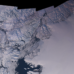
Northern Greenland in Autumn 2021
Landsat image of Wulff Land and Warming Land in Northern Greenland with low sun from the southwest.
| view data | |
|---|---|
| Location: | 49.988° W, 81.656° N |
| Altitude: | 700 km |
| View Direction: | 0° |
| Camera Angle: | 0° |
| Available size: | up to 12060×6988 pixel |
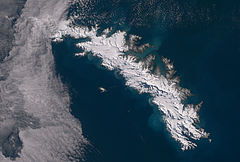
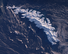
South Georgia in early Spring 2021
Sentinel-2 image of South Georgia at the beginning of the 2021-2022 summer season with cloud cover only in the northwest.
| view data | |
|---|---|
| Location: | 36.72° W, 54.29° S |
| Altitude: | 786 km |
| View Direction: | 0° |
| Camera Angle: | 0° |
| Available size: | up to 18200×12300 pixel |
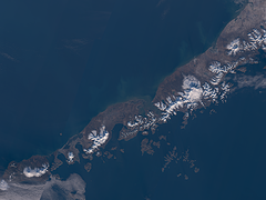
Mount Aniakchak in Autumn 2021
Sentinel-2 image of Mount Aniakchak and Mount Chiginagak on the Alaska Peninsula in autumn 2021 with some fresh snow at higher elevations.
| view data | |
|---|---|
| Location: | 157.9° W, 57° N |
| Altitude: | 786 km |
| View Direction: | 0° |
| Camera Angle: | 0° |
| Available size: | up to 13600×7900 pixel |
South Sandwich Islands in Winter 2020
Almost cloud free Sentinel-2 mosaic of the South Sandwich Islands in Winter 2020 showing sea ice reaching very far northward beyond Zavodovski Island
| view data | |
|---|---|
| Location: | 27° W, 58° S |
| Altitude: | 786 km |
| View Direction: | 0° |
| Camera Angle: | 0° |
| Available size: | up to 20000×40000 pixel |
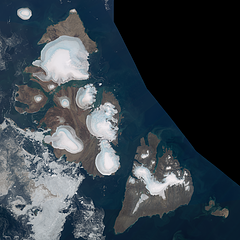
Severnaya Zemlya in August 2020
Cloud free Sentinel-2 mosaic of Severnaya Zemlya in August 2020 featuring an almost ice free Laptev Sea while there is some drift ice remaining on the eastern Kara Sea.
| view data | |
|---|---|
| Location: | 97° E, 79.6° N |
| Altitude: | 786 km |
| View Direction: | 0° |
| Camera Angle: | 0° |
| Available size: | up to 40000×40000 pixel |
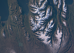
Summer evening view of northern Iceland
Landsat 8 evening image of northern Iceland with Tröllaskagi and the town of Akureyri.
| view data | |
|---|---|
| Location: | 18.5° W, 65.5° N |
| Altitude: | 700 km |
| View Direction: | 0° |
| Camera Angle: | 0° |
| Available size: | up to 10414×7458 pixel |
Spring in northern Russia
Sentinel-2 mosaic of the thawing Tundra in June 2018 in northeastern Russia (Sakha Republic) at the Arctic Ocean coast.
| view data | |
|---|---|
| Location: | 151.5° E, 71° N |
| Altitude: | 786 km |
| View Direction: | 0° |
| Camera Angle: | 0° |
| Available size: | up to 60000×40000 pixel |
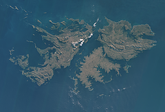
Falkland islands in Winter
Sentinel-2 mosaic of the Falkland islands in early Winter 2018 with low sun position but without snow.
| view data | |
|---|---|
| Location: | 59.5° W, 52° S |
| Altitude: | 786 km |
| View Direction: | 0° |
| Camera Angle: | 0° |
| Available size: | up to 28000×19000 pixel |
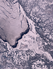
Arkhangelsk in Winter
Sentinel-2 image of Arkhangelsk and the mouth of the Northern Dvina River flowing into the White Sea in Winter (early 2018)
| view data | |
|---|---|
| Location: | 40° E, 64° N |
| Altitude: | 786 km |
| View Direction: | 0° |
| Camera Angle: | 0° |
| Available size: | up to 10000×13000 pixel |
Crete in Winter
Landsat mosaic of the island of Crete in winter with snow in the mountains. Assembled from Landsat imagery from 2016-2018.
| view data | |
|---|---|
| Location: | 25° E, 35° N |
| Altitude: | 700 km |
| View Direction: | 0° |
| Camera Angle: | 0° |
| Available size: | up to 18000×7000 pixel |
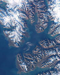
Autumn 2017 in Svalbard
Landsat 8 image of western Svalbard around Isfjorden in early October 2017
| view data | |
|---|---|
| Location: | 15° E, 78.3° N |
| Altitude: | 705 km |
| View Direction: | 0° |
| Camera Angle: | 0° |
| Available size: | up to 7923×9920 pixel |
Autumn 2017 in Alaska/Yukon
Sentinel-2 image of the Yukon River at the border of Alaska and Yukon(Canada), in Autumn 2017.
| view data | |
|---|---|
| Location: | 141° W, 64.5° N |
| Altitude: | 786 km |
| View Direction: | 0° |
| Camera Angle: | 0° |
| Available size: | up to 21500×15000 pixel |
Northeast Greenland Evening 2017
Landsat mosaic of Northeastern Greenland based on evening images from July/August 2017.
| view data | |
|---|---|
| Location: | 24° W, 75° N |
| Altitude: | 700 km |
| View Direction: | 0° |
| Camera Angle: | 0° |
| Available size: | up to 40000×98000 pixel |
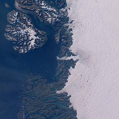
West Greenland Evening 2017
Landsat mosaic of Western Greenland near Ilulissat with Jakobshavn Glacier and Disko Bay based on evening images.
| view data | |
|---|---|
| Location: | 51° W, 69° N |
| Altitude: | 700 km |
| View Direction: | 0° |
| Camera Angle: | 0° |
| Available size: | up to 22000×22000 pixel |
South Georgia in Winter 2017
Landsat mosaic of South Georgia in Winter 2017 with exceptionally good weather and nearly no clouds over the island.
| view data | |
|---|---|
| Location: | 37° W, 54° S |
| Altitude: | 700 km |
| View Direction: | 0° |
| Camera Angle: | 0° |
| Available size: | up to 12000×9500 pixel |
Alaska Peninsula in Winter
Landsat mosaic of the Alaska Peninsula from Mount Aniakchak to Unimak Island in early January 2017 with low sun position and snow covered mountains.
| view data | |
|---|---|
| Location: | 162° W, 55.3° N |
| Altitude: | 700 km |
| View Direction: | 0° |
| Camera Angle: | 0° |
| Available size: | up to 32000×24000 pixel |
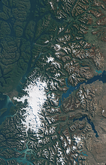
Autumn colors in Patagonia
Sentinel-2 image of the Andes Mountains in Patagonia and the Northern Patagonian Ice Field in Autumn with deciduous Nothofagus forests in strong red colors.
| view data | |
|---|---|
| Location: | 73° W, 46° N |
| Altitude: | 786 km |
| View Direction: | 0° |
| Camera Angle: | 0° |
| Available size: | up to 21500×33500 pixel |
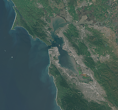
Spring in San Fancisco
The San Fancisco Bay area in April 2016. Image is based on Copernicus Sentinel data from 2016, attribution required.
| view data | |
|---|---|
| Location: | 122.4° W, 37.75° N |
| Altitude: | 786 km |
| View Direction: | 0° |
| Camera Angle: | 0° |
| Available size: | up to 14000×13000 pixel |
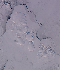
Severnaya Zemlya in early Spring 2016
Landsat mosaic of Severnaya Zemlya from late March/early April 2016 with the islands nearly fully snow covered, land fast sea ice between and around the islands and pack ice around on the Kara Sea and the Laptev Sea.
| view data | |
|---|---|
| Location: | 97° E, 79.6° N |
| Altitude: | 700 km |
| View Direction: | 0° |
| Camera Angle: | 0° |
| Available size: | up to 24000×28000 pixel |
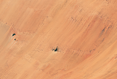
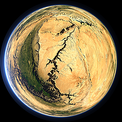
Lakes of Ounianga
The Lakes of Ounianga are a number of groundwater fed lakes in the eastern Sahara desert in northeastern Chad that form a remarkable landscape feature in the otherwise dry desert. Image is based on Copernicus Sentinel data from 2016, attribution required.
| view data | |
|---|---|
| Location: | 20.7° E, 19° N |
| Altitude: | 786 km |
| View Direction: | 0° |
| Camera Angle: | 0° |
| Available size: | up to 10680×7256 pixel |
Franz Josef Land in Summer 2015
Landsat mosaic of Franz Josef Land vom Ende Juli 2015, some weeks before the snow minimum with remains of drift ice between the islands in the otherwise largely ice free polar ocean.
| view data | |
|---|---|
| Location: | 56° E, 80.7° N |
| Altitude: | 700 km |
| View Direction: | 0° |
| Camera Angle: | 0° |
| Available size: | up to 25000×16333 pixel |
Franz Josef Land in early Spring 2015
Landsat mosaic of Franz Josef Land from late March/early April 2015 with the islands nearly fully snow covered, land fast sea ice between the islands and pack ice around on the ocean.
| view data | |
|---|---|
| Location: | 56° E, 80.7° N |
| Altitude: | 700 km |
| View Direction: | 0° |
| Camera Angle: | 0° |
| Available size: | up to 25000×16333 pixel |
Northeast Greenland in August
Landsat mosaic of the coast of Northeast Greenland in August 2014 showing the eastern edge of the Greenland Ice sheet with the Nioghalvfjerdsbrae and the Zachariae Isstrom, Kronprins Christian Land and the Independence Fjord as well as the coastal and sea ice situation at the height of summer.
| view data | |
|---|---|
| Location: | 21° W, 79° N |
| Altitude: | 700 km |
| View Direction: | 0° |
| Camera Angle: | 0° |
| Available size: | up to 32600×42800 pixel |
The South Sandwich Islands in late Winter
Landsat mosaic of the South Sandwich Islands in late winter 2014 including Southern Thule, Bristol, Montagu, Saunders and Candlemas Islands as well as Visokoi Island, the latter mostly covered by clouds. The ocean shows extensive sea ice coverage as well as various icebergs well visible in the low sun.
| view data | |
|---|---|
| Location: | 27° W, 58° S |
| Altitude: | 700 km |
| View Direction: | 0° |
| Camera Angle: | 0° |
| Available size: | up to 13000×22600 pixel |
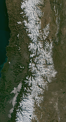
The Southern Andes in Winter
Landsat mosaic of the Southern Andes mountains in Winter 2014 at the border between Chile and Argentina with Santiago de Chile and the Aconcagua near the Center.
| view data | |
|---|---|
| Location: | 70° W, 34° S |
| Altitude: | 700 km |
| View Direction: | 0° |
| Camera Angle: | 0° |
| Available size: | up to 21000×38667 pixel |
The Nares Strait in Autumn
Landsat mosaic of the Nares Strait between Greenland and Ellesmere Island in Autumn, divided into Baffin Bay, Smith Sound, Kane Basin, Kennedy Channel, Hall Basin and Robeson Channel
| view data | |
|---|---|
| Location: | 67° W, 80.5° N |
| Altitude: | 700 km |
| View Direction: | 0° |
| Camera Angle: | 0° |
| Available size: | up to 48000×48000 pixel |
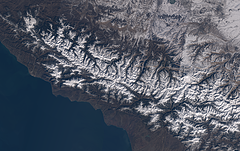
The western Caucasus
Landsat mosaic showing the western part of the Caucasus mountains at the coast of the Black Sea in Russia and Georgia. Assembled from images from January/February 2014.
| view data | |
|---|---|
| Location: | 42° E, 43° N |
| Altitude: | 700 km |
| View Direction: | 0° |
| Camera Angle: | 0° |
| Available size: | up to 21000×13200 pixel |
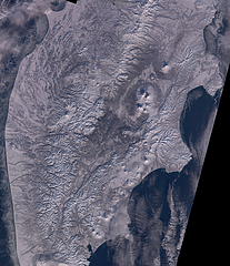
Kamchatka in Winter
Landsat mosaic showing the Kamchatka peninsula in eastern Russia in Winter. Assembled from images from January/February 2014
| view data | |
|---|---|
| Location: | 160° E, 56° N |
| Altitude: | 700 km |
| View Direction: | 0° |
| Camera Angle: | 0° |
| Available size: | up to 34480×40000 pixel |
McMurdo Sound
Landsat mosaic showing McMurdo Sound in Antarctica with Ross Island, the Ross ice shelf and the McMurdo Dry Valleys. Assembled from ascending orbit (nighttime) Landsat images from November 2013
| view data | |
|---|---|
| Location: | 166° E, 78° S |
| Altitude: | 700 km |
| View Direction: | 0° |
| Camera Angle: | 0° |
| Available size: | up to 16000×17333 pixel |
The Ellsworth Mountains
Landsat mosaic showing the Ellsworth Mountains in Antarctica including the Vinson Massif which is the highest point of the Continent. Assembled from images from early spring (October/November 2013)
| view data | |
|---|---|
| Location: | 85° W, 79° S |
| Altitude: | 700 km |
| View Direction: | 0° |
| Camera Angle: | 0° |
| Available size: | up to 25000×10000 pixel |
The Transantarctic Mountains
Landsat mosaic showing the Transantarctic Mountains between the Nimrod Glacier in the south (top) and McMurdo Sound in the north (bottom). Includes Byrd Glacier, McMurdo Dry Valleys and Ross Island. Assembled from images from early spring (October/November 2013)
| view data | |
|---|---|
| Location: | 160° E, 80° S |
| Altitude: | 700 km |
| View Direction: | 0° |
| Camera Angle: | 0° |
| Available size: | up to 25200×45000 pixel |
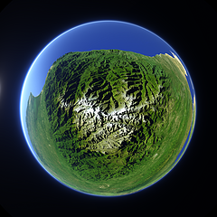
Fisheye view of the Sierra Nevada de Santa Marta
Fisheye view of the Sierra Nevada de Santa Marta in northern Colombia.
| view data | |
|---|---|
| Location: | 73.65° W, 10.85° N |
| Altitude: | 29 km |
| View Direction: | 0° |
| Camera Angle: | 280° |
| Available size: | up to 3600×3600 pixel |
Blog news:
Todays featured image:

