Imagico.de
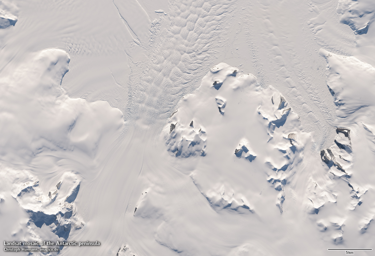
Landsat mosaic of the Antarctic peninsula

In this Landsat mosaic of the Antarctic peninsula I processed and assembled Landsat images for the area of the Antarctic peninsula covering both Graham Land and Palmer Land as well as Alexander Island and the various smaller islands around in a uniform image with realistic colors.
This Landsat mosaic can be considered a higher resolution supplement to the Green Marble and similarly it represents the surface color with compensation for the effects of the atmosphere. Selection of source data is targeting a late summer time frame with priority on late January and selection of images as closely to this date as possible for the land and for minimum sea ice cover over water.
Source data is almost exclusively Landsat 8 imagery from end 2013 to early 2015 with only very few small areas where this has been supplemented by Landsat 7 imagery from 2007-2014.
Compared to the LIMA this mosaic offers not only a much newer data basis, it also shows more and clearer details, more consistent and realistic coloring as well as much less disturbance from clouds.
Key properties
- Visible color mosaic of the Antarctic peninsula
- 15m base resolution, total size 88000x88000 pixel
- Based on Landsat imagery, primarily Landsat 8 from 2013-2015, <1 percent from Landsat 7 2007-2014
- Ocean color based on Green Marble
- Shows atmosphere compensated surface color, available either as linear surface reflectance values or tone mapped for direct display
- Assembled in polar stereographic projection (EPSG:3031), can be made available in other projections.
Sample gallery


If you are interested in using this Landsat mosaic use the form below to describe your needs and i will get back to you.
Data inquiry
Blog news:
Todays featured image: