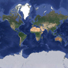
I am usually not much interested in new imagery on Google maps since what they do is mostly unsystematic and uninspired throwing-together of images from various sources – possibly nice if you want to see the molehills on your lawn on the internet but unpleasent from any esthetic point of view. But they have now put up a major update of their image base at low magnifications that deserves a closer look and some comments.
In short what Google did is replace the base data for most of the land surfaces in the satellite view with more recent Landsat 7 images. Previously they used a Landsat mosaic from 1999-2003 as it has been and is still widely used in web maps that has been mechanically assembled from Landsat scenes with low cloud cover without actual cloud removal. In contrast to other maps which often use MODIS data for the lowest zoom levels Google has used and is still using the Landsat mosaic from the lowest magnification.

Their new mosaic seems to be exclusively based on Landsat 7 data which – after 2003 – is hampered by the SLC defect that makes use of this data quite difficult. Google now made use of the newer Landsat 7 data despite this problem and it is interesting to see the results. First of all the new images are a great improvement in terms of color to what they previously showed at low zoom levels. The new images can be said to more or less resemble actual appearance of the earth surface which could not be said for the previous data.
What they did with the SLC-off data follows the usual Google brute force approach – throwing huge amounts of data together based on the assumption that with enough data you get reasonable results even if the processing used is fairly dumb. The result is impressive – if you look at my usual test area for cloud cover:

Note comparing it to a MODIS mosaic (like in my previous look at the Mapbox image) is somewhat unfair since MODIS provides an image every day while Landsat does so only every two weeks and these images also have the SLC gaps. Interestingly there are also areas with visible cloud cover where i know cloud free (or at least less clouds) Landsat 7 scenes exist – like on Bioko Island where Google shows widespread clouds despite scenes with much less cloud cover being available. This and observations elsewhere indicate that they did not include the most recent years in their data collection or at least did not give priority to the more recent scenes. This means on average the new imagery is probably at least 5 years old.
Already recognizable in the Bioko island example was the quite visible striping that can be widely seen in the images, especially in areas where there is significant seasonal or other variation between the images used. Google used a different approach to merging the images than Mapbox did for their MODIS mosaic – unavoidably since the higher resolution of the images (30/15 meter vs. 500/250 meter) causes various specific problems when merging them. But as already indicated their technique seems to be fairly simple relying on the sheer mass of data helping to produce a reasonable result. This works well in uncritical areas like deserts but less so elsewhere. If you combine data from images with different lighting at short distance the result is inconsistent and irritating to the viewer making it difficult to understand. Since Google also applied a significant amount of blending and mixing when combining the images the result is also quite blurry in many areas leading to a lower resolution than what could be expected from the original Landsat data.


Finally the new mosaic is not truly global, various islands which are inside the Landsat coverage are not included in the mosaic. But this is nothing new – completeness on any level has never been something Google could be proud of as can be illustrated by many examples.
In contrast to Bing and other map services that allow use of their imagery for mapping in Openstreetmap Google Maps images cannot be used outside Google. But from what i saw in my first look now this is no big loss with regards to the new Landsat 7 mosaic since the issues described above would severely limit the useability for mapping purposes. The images are newer than the common 1999-2003 mosaics but only by a few years and not truly up-to-date. There are much less clouds than in all other global Landsat mosaics available but when you can use individual Landsat scenes there is no real advantage in this for mapping purposes. As said the colors are a big improvement also in comparison to Landsat derived images elswhere like on Bing but that is just about it.
On the other hand with this Google has been the first to retire the classic 1999-2003 Landsat mosaic in their image base replacing it with something newer (except for Antarctica). Elsewhere this step is still to be done not to say overdue with the current data between 10 and 15 years old. Mapbox has already announced to be working on a mosaic based on the Landsat 7 SLC-off data. Others might want to use the new Landsat 8 images although it will take a few years till there is enough data for a global cloud free mosaic. And of course there is also a fair amount of Landsat 5 imagery until 2011 that can be used.