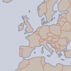
In my previous work on generalization of geodata for map rendering, including coastlines, waterbodies, settlements and relief i have so far not covered administrative boundaries. The main reason is boundaries are very tricky in this regard. The vast majority of … Continue reading

December 15, 2014
by chris
0 comments