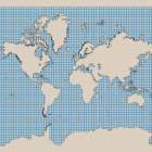
On openstreetmapdata.com Jochen and me provide daily updated processed OpenStreetMap coastline data for use in maps and elsewhere. It is used for example by the standard map on openstreetmap.org to provide an up-to-date rendering of the coastline. This data is … Continue reading
February 28, 2016
by chris
0 comments

