I have produced a new generalized coastline data set you can download and also put together a new update of my coastline data quality analysis.
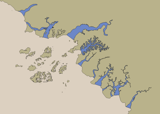
The main news is: The generalized coastlines are now – at least for the moment – no more based directly on the OpenStreetMap coastline. The reason is the increasing trend to exclude coastal water areas from the coastline and map them separately as water polygons. Here an example from the West African coast:
I explained this in more detail in the coastline quality report. While previously the only processing i did on the coastline data as generated by OSMCoastline was removing the large lakes still tagged natural=coastline i now also add a number of water polygons that have been removed from the coastline although they – at least to a large part – belong to the maritime domain, i.e. are dominated by ocean currents and form maritime ecosystems. For the moment this is just a collection of OSM IDs – in case you are interested here it is:
- Ways: 212722394 211148691 96323040
- Relations: 3474227 1620851 1625415 1624816 2837701 3320603 1991868 1991918 2453824 1988610 3799122 3801531 3801633 3804564 3796288 3796287 3793491 3935219 3793490 3728593 3111444 414066 2317228 1850548
I have the hope this trend will reverse again over time and this list can shrink again – if not i will probably add some tag to those features (maritime=yes comes to mind) to manage them. I suppose mappers who tagged these features at least sometimes have good reason to do so. In most cases i would assume simply having both the water polygon and the coastline like it is done for the Elbe river for example could make everyone happy.


