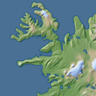
I recently published some thoughts on generalization and included some samples of generalized coastlines there. I have now cleaned up the program used for that and make it available as open source. I also put up a set of files containing generalized coastlines for the whole earth based on Openstreetmap data for web map zoom levels 1 to 8.
Both are free to use for anyone, the generalization tool under the terms of the GPL, the generalized coastline data under the CC-BY-SA license. If you find those useful please consider supporting my work using the link on the data download page or by buying a print or comissioning a custom image on services.imagico.de.