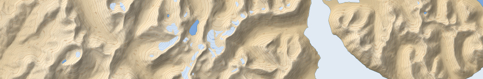
After the recent waterbody data reprocessing i also updated the glacier data in my maps. This now includes complete mapping of the glaciers of the Russian Arctic which is also available as a separate data set. The Russian glaciers are very incomplete in both OpenStreetMap and GLIMS. This fills the gaps in the Arctic regions and also provides more up-to-date and more detailed data in areas where GLIMS has coverage (like Novaya Zemlya). For those glacier systems currently completely missing in OpenStreetMap this data will also be added there – for those areas where OSM already contains some glacier mapping – often based on more detailed imagery like in the Ural and Chersky mountains this is going to be more difficult.

Most of the mountain glaciers are of course not visible at the low zoom levels – here is an example from the Pylginsky Mountains in the far east at zoom level 12:

There are still plenty of unmapped glaciers in Russia further south of course, most notably on Kamchatka.