After more than a year without changes i added a number of new images for mapping in OpenStreetMap to my collection. The reason for the gap was that i needed to make some changes to allow the setup to scale better after the tile database had grown to more than 10GB.
What i added so far is:
A new Sentinel-2 image of Ushakov Island – the last larger island discovered on Earth in 1935 – and which due to changing ice margins could use an update in OSM.
Two new Landsat images of Northern Greenland from this year – the first from early July and the second from late July. Both have quite a bit of cloud cover so you need to look which is best in the particular area you want to map. You can also still find the older images i previously added for the area.
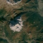
An autumn colors Sentinel-2 image from 2019 of the eastern Alps supplementing the one from the western Alps i added before. This is useful for leaf_cycle mapping of forests and in some areas also for updating glacier extents. But beware that there is some fresh snow in October already of course.
An updated Sentinel-2 image of the Vostochny Cosmodrome in eastern Russia from September this year featuring autumn colors in addition to the current status of construction work.
All new images are going to be available in the editors soon probably – if you can’t wait you can also add them manually based on the links provided on my preview map.

