Some might have noticed that in spring i skipped my usual report on the OpenStreetMap coastline data quality. I have now prepared a whole year update on that as well as a similar report on the glacier data (where my original report was from end 2013)
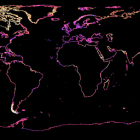
Short summary: Nothing big has happened with either coastlines or glaciers. There is steady progress though, which is nice to see especially in case of glaciers which is generally not a very popular subject. Here are the current node age maps for both – click on the images to read the full reports:


Not that much has changed about the worst parts of the OpenStreetMap coastline but there is some progress. Which inevitably leads me to the list of most serious errors of the coastline a.k.a. the best chances for membership in the zoom level zero club:
- The Rann of Kutch at the India/Pakistan border, see here which should not be coastline since it is only seasonally flooded (slightly changed but still more than 50km error)
- Northwest Ellesmere Island (more than 20km error)
- Eastern Greenland ice coast (about 20km error, glacier and coastline are not consistent in OSM here, Bing and many other satellite mosaics are not correct either)
- Various parts of eastern Sulawesi (~7km)
- Miller Island near Ellesmere Island in northern Canada (~6km)
- Southern Chile coast (moved down in the list due to improvements but still errors of several km)
- Southeast coast of Nordaustlandet, Svalbard (more than 5km due to glacier changes)
Eastern Devon Island (20km error)fixed!Kirov Islands, Kara Sea in northern Russia (~10km)fixed!Seluan Island in Indonesia (~5km)fixed!