Like almost everyone else i have been constrained in my work and life during the past weeks due to the global pandemic we are experiencing and the measures enacted to counter its spread. I used parts of this time to complete a project i have been working on on the side for the past few months and i want to introduce the results here.
That project was the update of the most successful product i have in my portfolio – the Green Marble global satellite image mosaic. Introduced in 2014 this was – and still is – the highest quality solution for an accurate visual color depiction of the whole earth surface on the market. But despite this still being the case the data basis of the image was becoming a bit dated and there are also a number of quality deficits i was looking into improving on for quite some time.
I am going to cover the various elements of improvement in more detail in the following.
Redesigned data processing for the polar regions
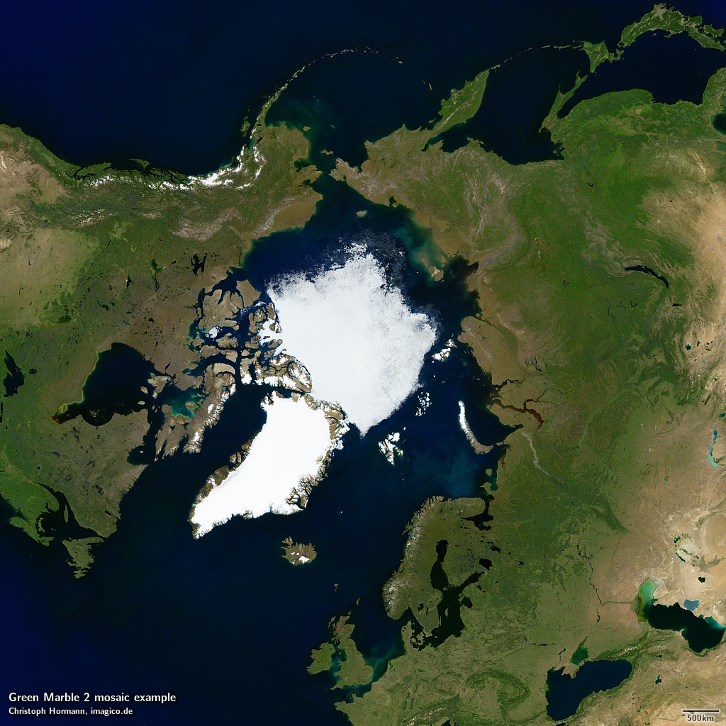
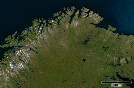
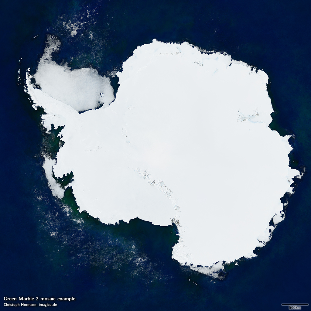
Arctic coverage of Green Marble 2
The so far unsurpassed quality of the Green Marble version 1 was the result in large parts of an innovative adjustment of the data processing to the different climate zones and seasonalities of the planet. Yet the fundamental process used was the same for the whole planet. This approach had its limitations in particular in the Antarctic (due to the very different climate as well as the differences in upstream data processing) and in some high latitude areas on the northern hemisphere. For the new version of the mosaic i therefore designed a new process for mosaic generation at high latitudes – both in the north and the south – that allows for lower noise levels and better differentiation of the color nuances. Source data for this is MODIS surface reflectance data like for the lower latitudes which allows seamless integration with the rest of the image.


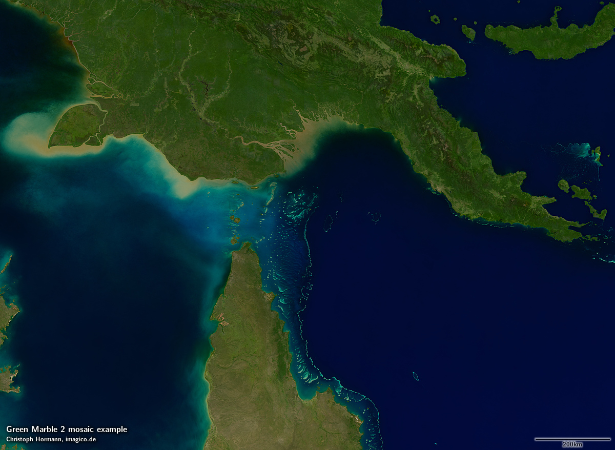
As a byproduct this process offers (with some quality constraints on the northern hemisphere) the production of separate mosaics featuring different shading from the Terra and Aqua satellites (showing morning and afternoon lighting respectively) in addition to the standard partly shading compensated version. Here an example for these different variants from the Antarctic.
Transantarctic mountains with default partial shading compensated rendering
Transantarctic mountains with morning lighting
Transantarctic mountains with afternoon lighting
Water rendering from Sentinel-3 data
The second big change is that water depiction is now based on Sentinel-3 OLCI water relectance data. This means the oceans are now shown in approximately the same resolution as the land areas while in the version 1 mosaic only coastal waters were in high resolution and the open ocean was shown based on lower resolution data. Overall this change leads to a much more uniform ocean rendering. The use of MODIS land surface relection data for water depiction was always not quite ideal.
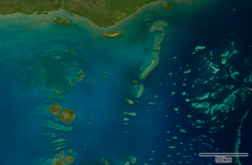

A few words on resolution in this context – some might wonder if the 300m vs. 250m nominal resolution difference of Sentinel-3 OLCI vs. MODIS makes a difference here – it does not. MODIS only offers 250m resolution in the red band anyway and water reflectance is primarily in the blue domain. All data processing was performed on a 250m grid and in the results i could not tell which is better. But definitely the final results due to the broader data basis offer lower noise levels and better acuity.
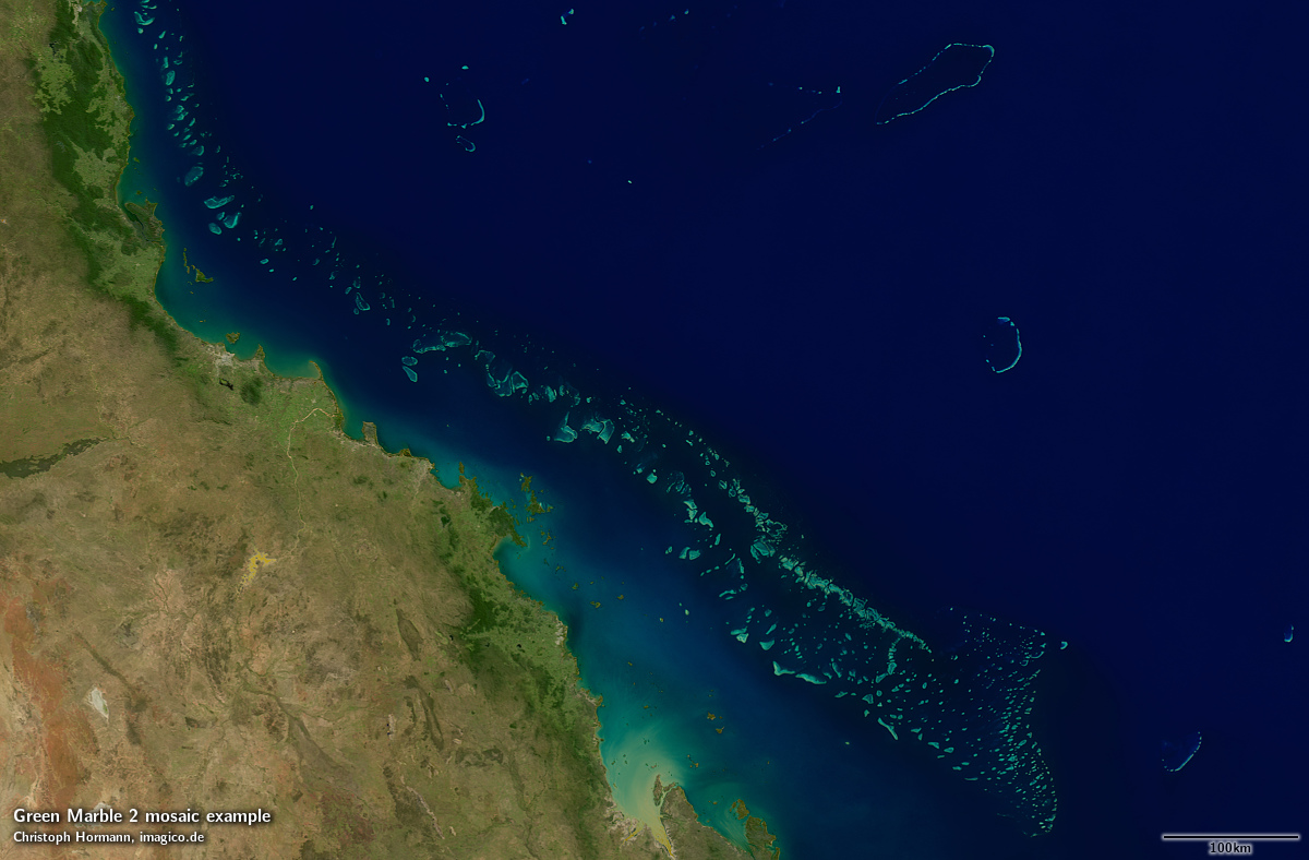
Great Barrier Reef

West African coast
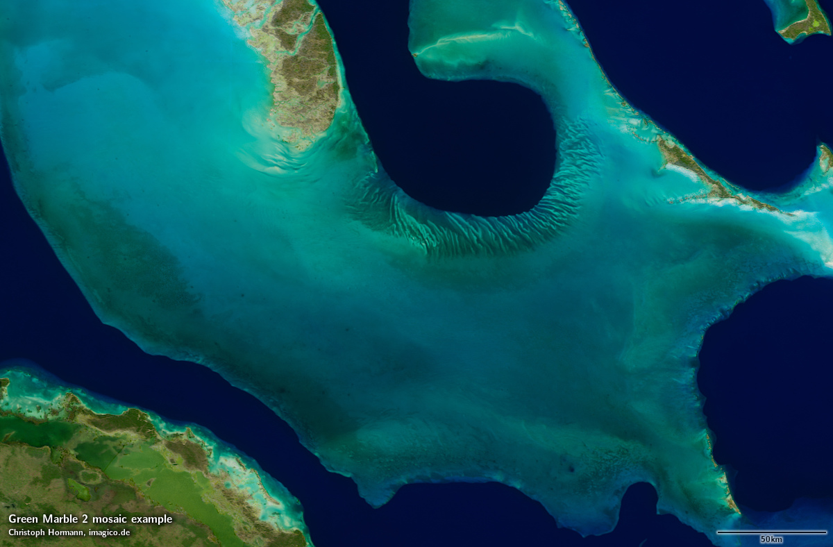
The Bahama Banks
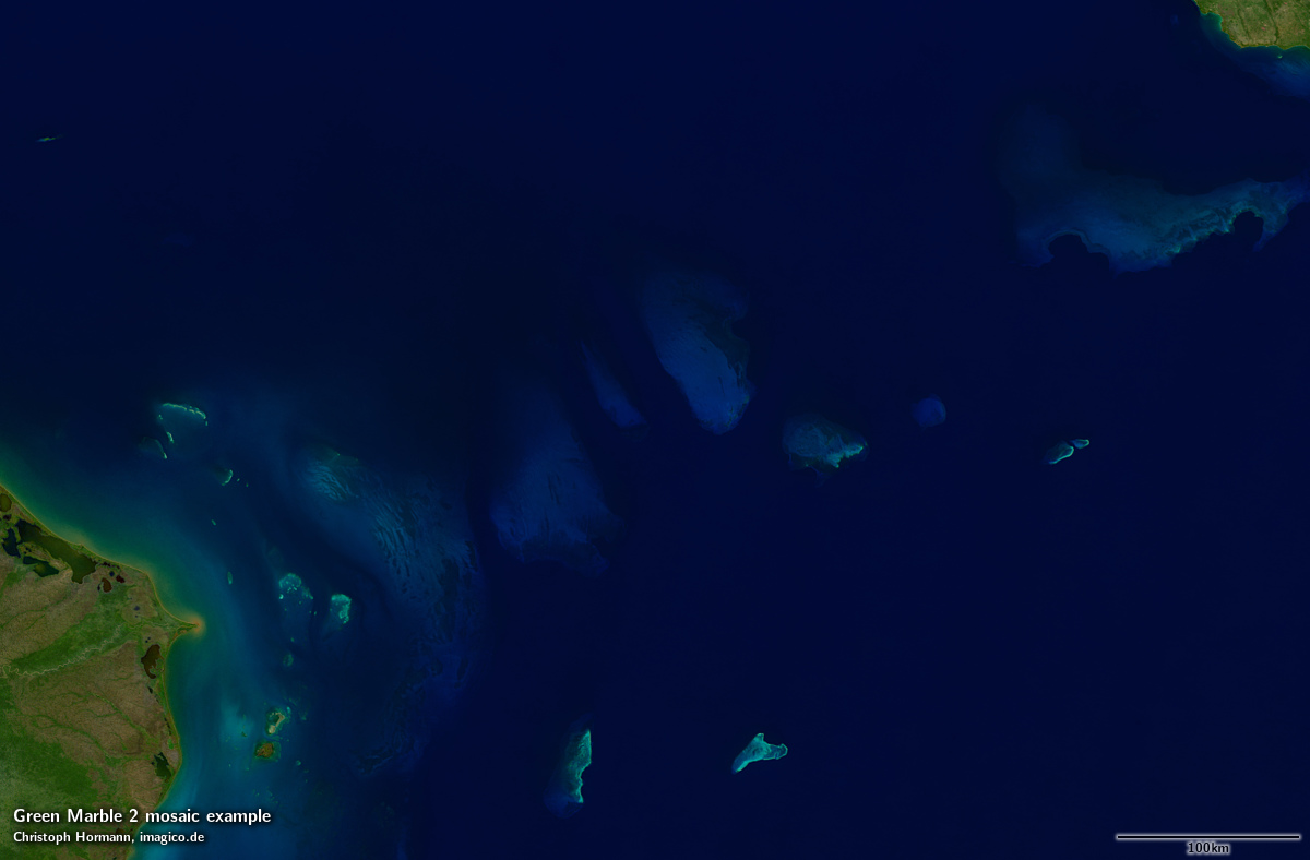
The Caribbean Sea
More accurate colors
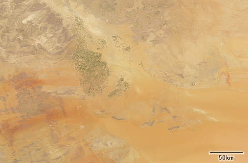
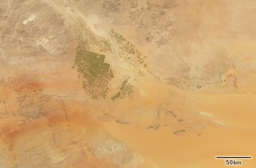
On the land surfaces changes in upstream processing and improvements in the mosaicing process allowed for more accurate and consistent color rendering in particular of unvegetated and sparsely vegetated areas. This is the third big change.


Broadened data basis
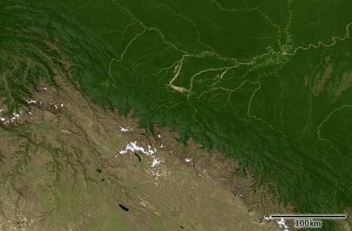
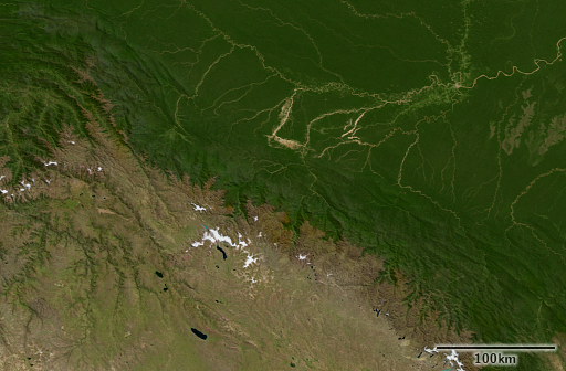
And finally the fourth big improvement comes from widening the data basis. This means globally extending the range of priority use data from three to four years as well as widening the extent of the further broadened data basis in the tropics. This leads to lower noise levels in particular in high cloud incidence areas. Overall more than 60 TB of MODIS data and more than 50 TB of Sentinel-3 data were processed for the production of this image.
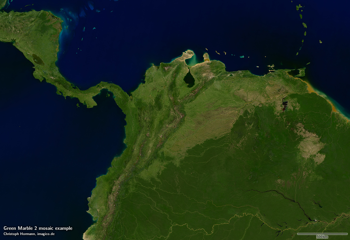
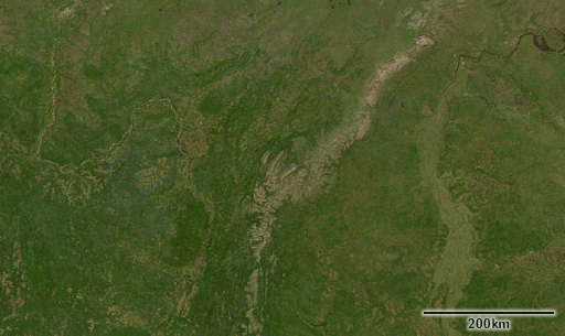
Northern South America
And of course the updated data basis also shows more recent changes in appearance of the earth surface.

Improved tone mapping
One of the problem in practical use of the Green Marble version 1 was the large range of reflectances across different parts of the earth surface – from dark green forest areas and dark blue ocean to bright snow and ice in the polar regions – and the difficulty of depicting that on screen. While the Green Marble version 1 was available as linear surface reflectance values and could be adjusted and optimized in rendering for specific settings the global mosaic in its default rendering was essentially overexposed in the Antarctic.
To actually be able to properly depict the high quality of the Antarctic data in the new mosaic i decided to by default use a locally adjusted tone mapping in the Antarctic region. Since this departs from the idea of a globally uniform depiction you can of course also obtain a constant tone mapping version.
Antarctic with locally adjusted tone mapping

Antarctic with globally uniform tone mapping
More samples
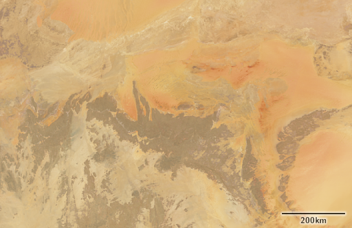
Here a few more samples from various parts of the world.
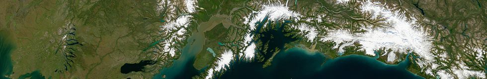
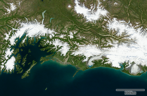
Southern Alaska
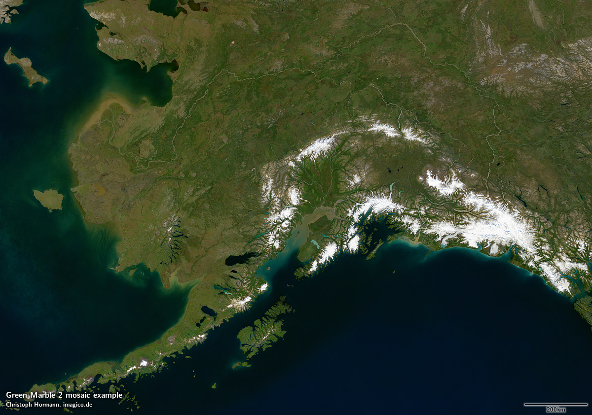
The Torres Strait
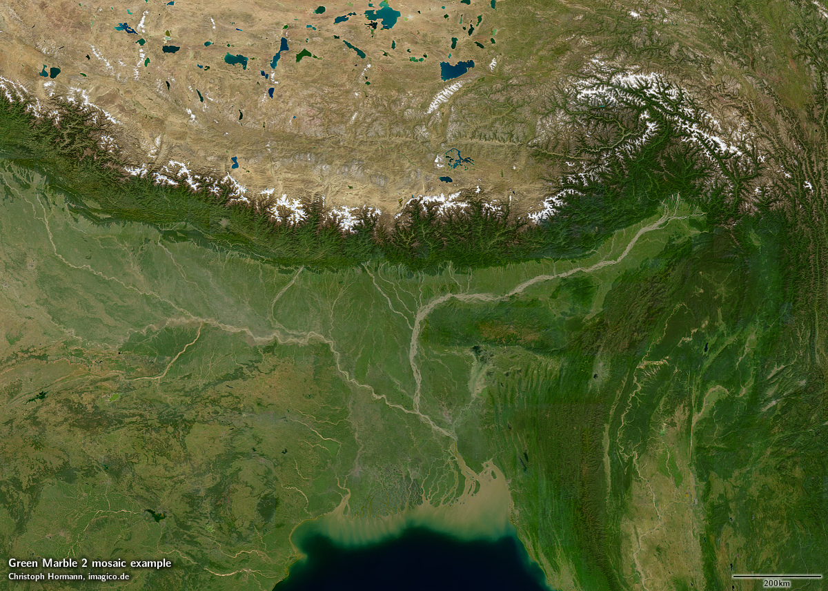
The Ganges delta and the eastern Himalayas
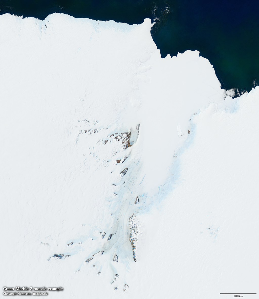
The Lambert Glacier
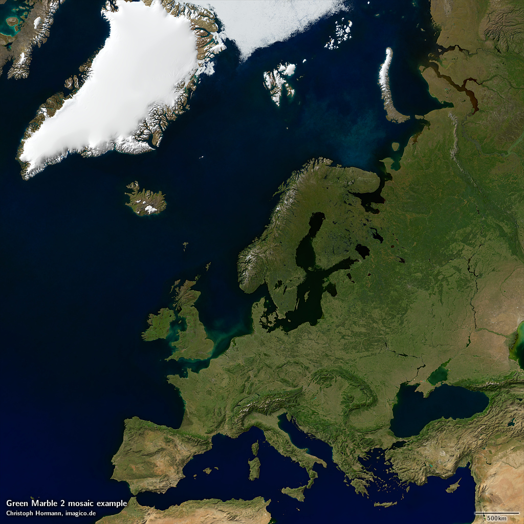
Europe with relief shading
An interactive map in Mercator-Projektion for further browsing can be found on maps.imagico.de.
You can find the updated specifications page for the Green Marble mosaic on services.imagico.de. Existing customers with a Green Marble version 1 license are eligible for a reduced price update to the new version. If you are interested in using the Green Marble in your application contact me through the form there or via email.