
The ESA recently made an interesting announcement about extending Sentinel-2B image recordings to lower sun positions in the northern hemisphere winter.
A bit of background on that: For the past years Sentinel-2 image recordings have traditionally been made only with relatively high sun positions compared to Landsat 8. The difference in the routine latitude based recording limit was not huge but it was noticable. This has led in particular to a significant under-use of the Sentinel-2 recording capacity in the northern hemisphere winter, especially since at the same time the Antarctic is only recorded at a lower frequency.
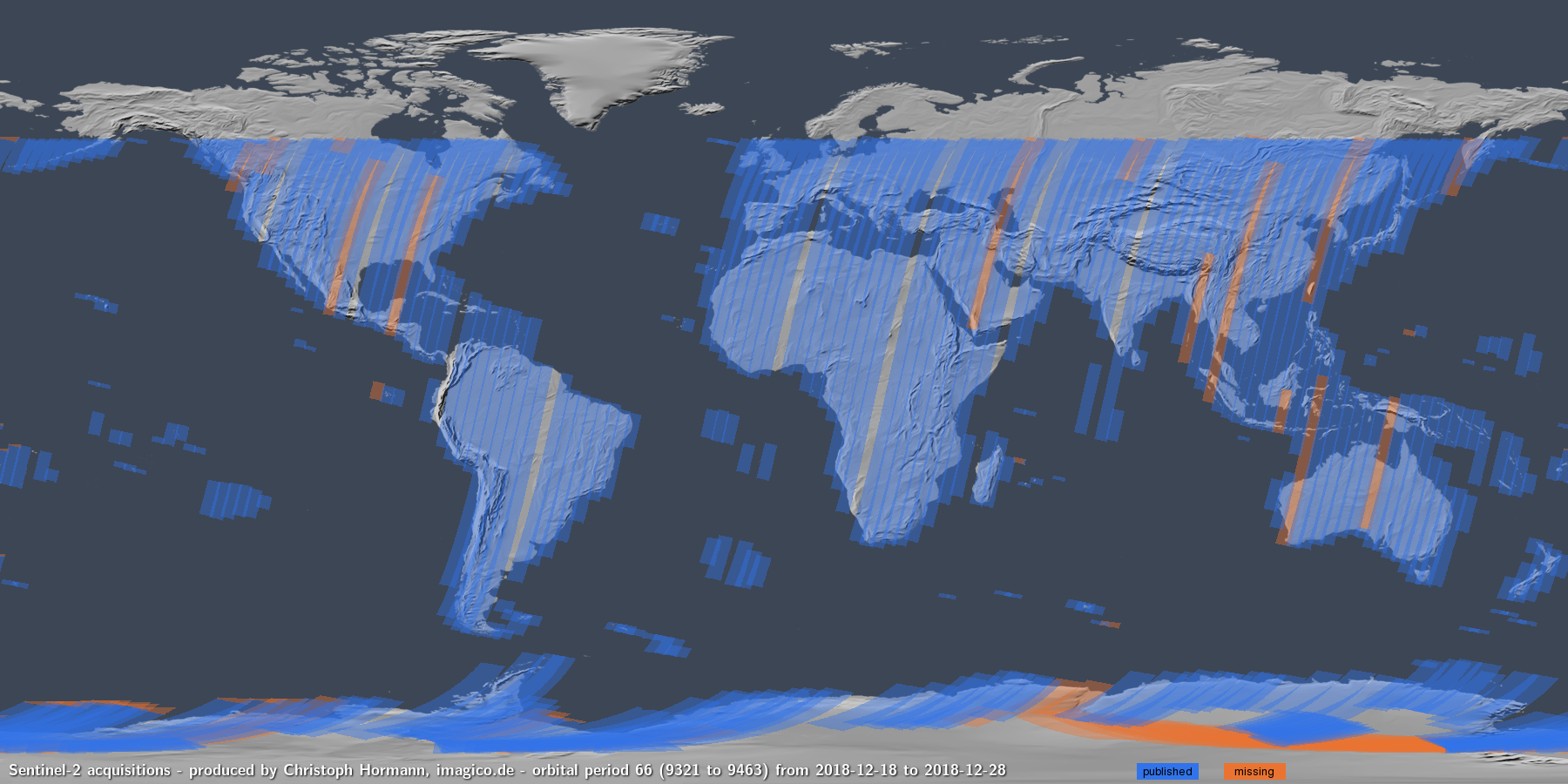
previous Sentinel-2 coverage in late December
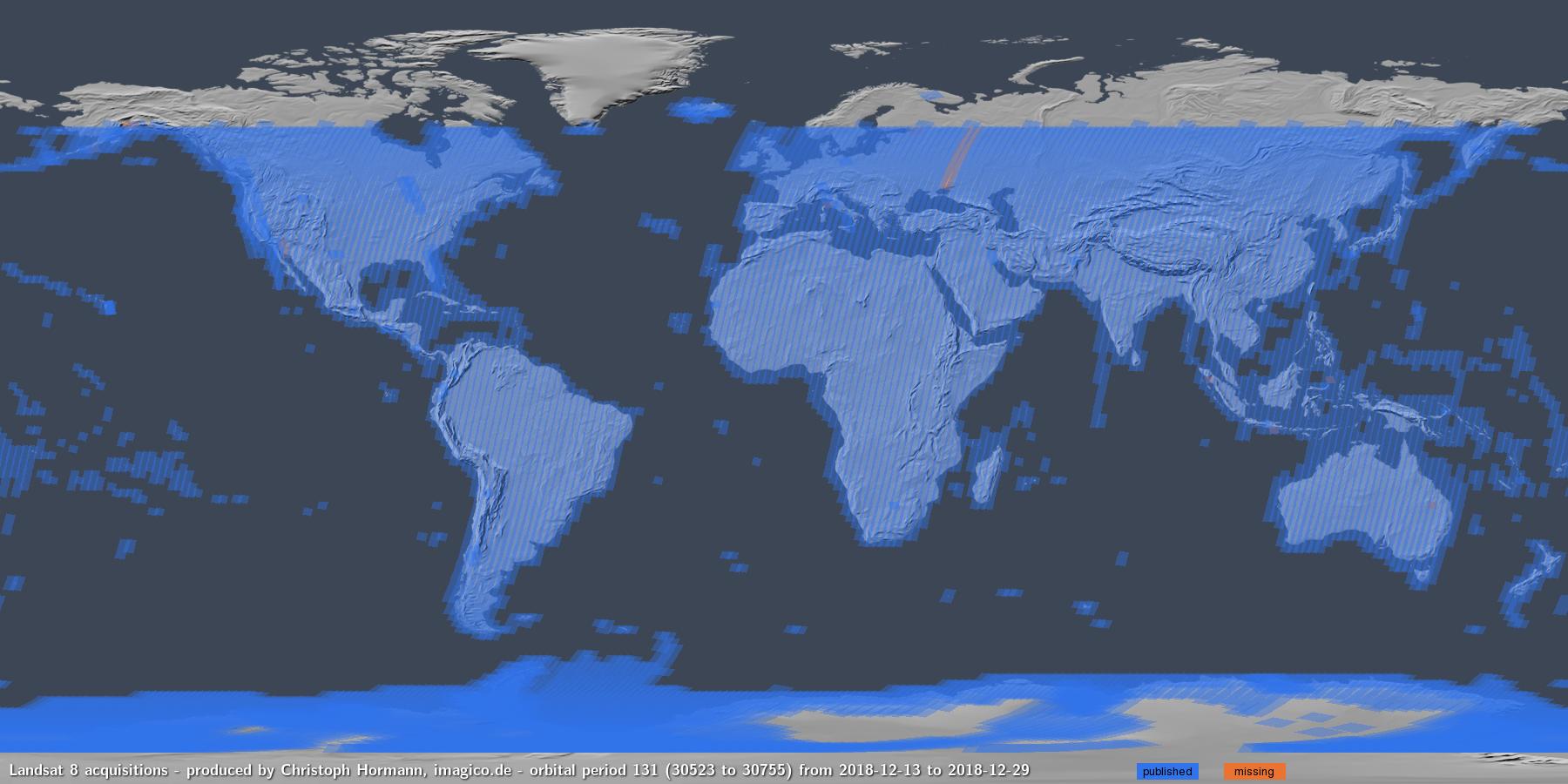
Landsat 8 coverage in late December
The change in recording plans announced now is somewhat half-hearted – it only applies to Sentinel-2B and it so far seems to be limited to Europe and Greenland. Here is a low sun position image recorded with this new pattern.
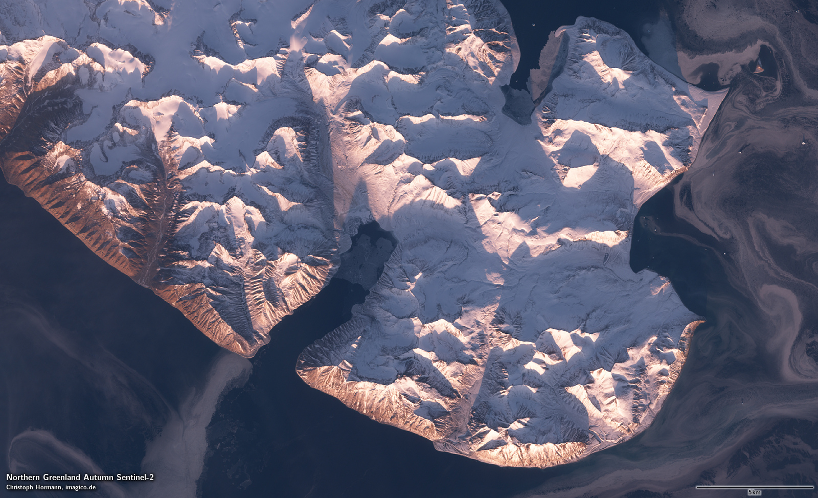
Low sun position Sentinel-2 recording in eastern Greenland
More generally speaking the recording patterns of Sentinel-2 are fairly static based on a fixed and politically decided recording plan while Landsat recordings are based on a priority list and typically they try to record as many images as possible given the operational capacity available. Or in other words: Sentinel-2 could probably be recoding significantly more imagery, in particular on the southern hemisphere and of low latitude islands during the northern hemisphere winter, if the option to record these when capacity is available was worked into the acquisition plan. But that would of course require the political decision to do so.
The real question is of course why the sun position based recording limit for Sentinel-3 OLCI data is even tighter than for Sentinel-2 – here the northern recording limit on the same date as the above Sentinel-2 sample – which is several hundred kilometers to the south.
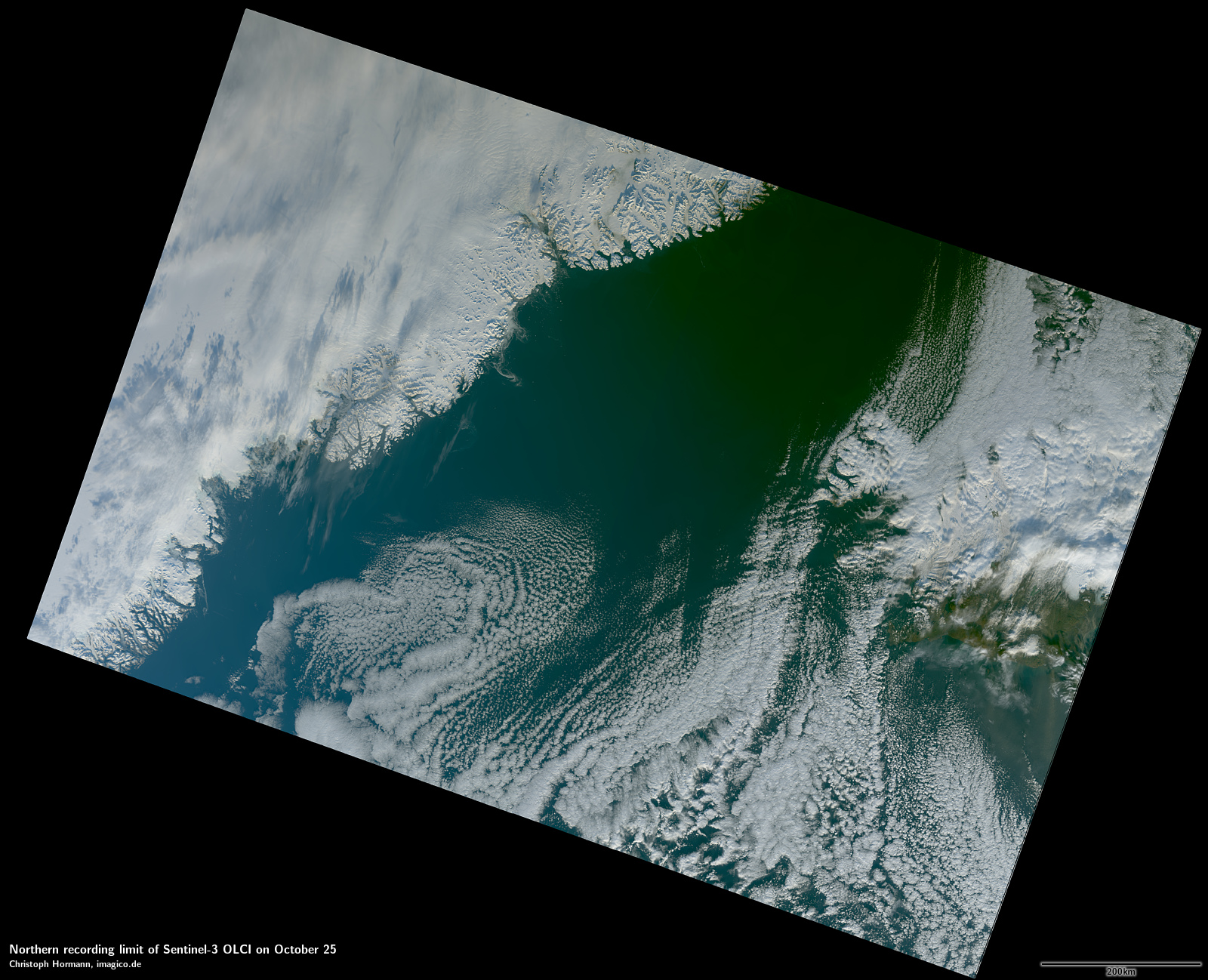
Sentinel-3 OLCI recording limit in eastern Greenland on October 25
Although Sentinel-3 records an earlier time slot than Sentinel-2 (10:00 vs. 10:30) and due to the wider field of view includes lower sun positions on the western side the sensible recording strategy would be to record everything that meets whatever sun position requirement is considered reasonable even if that practically means also recording positions with a lower sun position while in reality it seems no OLCI data is recorded where at the western end of the recording strip the sun position would be less than five degree above the horizon and this way you loose quite a lot of potentially useful data further to the east. In this case at the eastern end the recording starts at a sun position of about 11 degrees above the horizon.
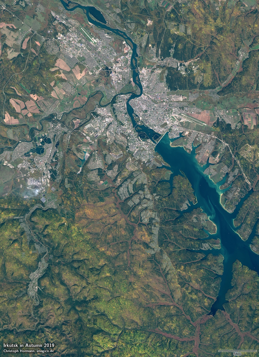
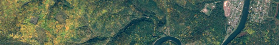
Autum colors near Irkutsk, Russia in September 2019 recorded by Sentinel-2
GCOM-C SGLI images
Not exactly news but i wanted to mention that images from the Japanese GCOM-C satellite’s SGLI sensor are available now (and have been for quite some time apparently) on the JAXA data portal. GCOM-C is a satellite system somewhat similar to Sentinel-3 in scope but offers some interesting additional features like polarized light sensors and an ultraviolet spectral band. The data is available under a liberal open data policy.
Here is a sample image of southeastern Europe:
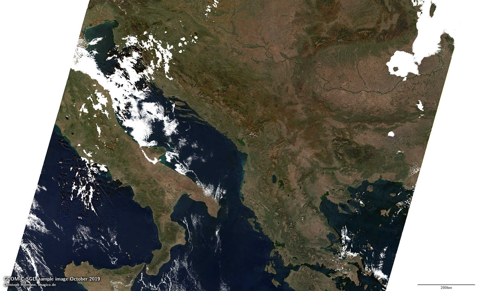
GCOM-C SGLI recording example