Mont Blanc
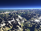
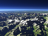
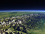
The Mont Blanc (4808m) is the highest peak in the Alps and lies at the border between France and Italy. This view from the south shows the fairly steep and rugged south side of the massif facing the Aosta Valley on the right. On the left the Haute-Savoie in France and in the background the Rhône valley.
| View: | Mont Blanc |
| Location: | Lon 6.564° Lat 45.452° |
| Altitude: | 13 km |
| Direction: | 30° |
| Camera Angle: | 26° |
| User Rating: | 2.5 |
Location Map: Visible Topography

Home •
Impressum •
Terms •
Sitemap •
Browse:
list
/
map /
gallery •

imagico.de • blog.imagico.de • services.imagico.de • maps.imagico.de • earth.imagico.de • photolog.imagico.de
imagico.de • blog.imagico.de • services.imagico.de • maps.imagico.de • earth.imagico.de • photolog.imagico.de


Visitor comments:
By submitting your comment you agree to the privacy policy and agree to the information you provide (except for the email address) to be published on this website.