Views of the Earth

artificial images of our real planet
Central Franz Josef Land location map

Central Franz Josef Land

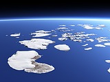
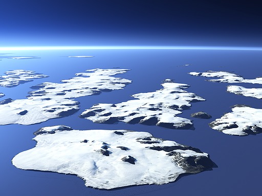
This view shows the central part of Franz Josef Land from the east with Wiener Neustadt Island in the foreground and Ziegler Island and Salisbury Island behind. Wiener Neustadt Island as well as many of the other islands got their names from an Austrian Expedition that first charted the islands in 1873. Franz Josef Land is located at the northeast end of Europe and the islands are mostly covered by glaciers.

View: Central Franz Josef Land
Location: Lon 60.196°
Lat 80.683°
Altitude: 11.863 km
Direction: 291°
Camera Angle: 40°
User Rating: -
Location Map:    Visible Topography
Central Franz Josef Land location map
Central Franz Josef Land

Related Views:

Rudolf Island
Franz Josef Land from east
Franz Josef Land from west
The Matochkin Strait

Visitor comments:

no comments yet.

Leave a comment
You have to enable Javascript to be able to write comments.
human verification Please enter the code you can see in the image on the left to verify you are a human and not a spamming script.
* * Required field
Information about you
*
will not be made public
will be displayed with your posting
Your comment (no HTML)

*

If you want to send a private message to the author of this website you can do so via Email.

The comments will be reviewed before they are added to the site. So you might need to wait some time until your entry turns up.

Please note this comment function is intended for commenting on the text and images, not for discussing political or religious views. Comments with no relation to the content of this site will not be approved.

By submitting your comment you agree to the privacy policy and agree to the information you provide (except for the email address) to be published on this website.

  
Design and Content Copyright 2023 by Christoph Hormann
last updated Sun, 16 Jul 2023 20:38