Imagico.de
Catalog search
Search parameters
Keywords: none specified
Style: any
Minimum available size: 5500 pixel
Longitude: 72° to 83°, Latitude: 26° to 43°
Purpose: for licensing
Results (?)
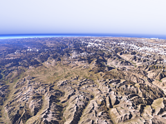
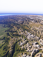
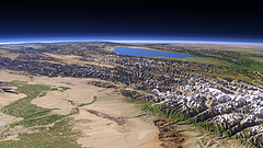
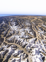
The Deosai plateau
View of the Deosai plateau from the east with the upper Indus valley to the right and the Nanga Parbat on the background left.
| view data | |
|---|---|
| Location: | 76.004° E, 34.539° N |
| Altitude: | 31.863 km |
| View Direction: | 322° |
| Camera Angle: | 66° |
| Available size: | up to 8000×6000 pixel |
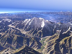
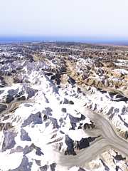
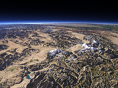
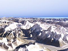
The Nanga Parbat
Closeup view of the Nanga Parbat from east with the Rupal Glacier, Bazhin Glacier and Chhungphar Glacier visible.
| view data | |
|---|---|
| Location: | 75.08° E, 35.156° N |
| Altitude: | 11.863 km |
| View Direction: | 282° |
| Camera Angle: | 32° |
| Available size: | up to 8000×6000 pixel |
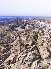
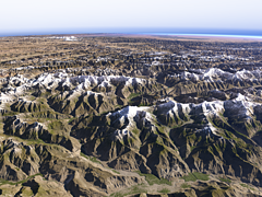
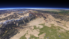
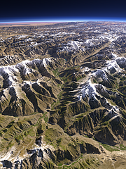
The Indus and Shyok Rivers
View westwards down the upper Indus on the left and the Shyok River on the right south of the Karakoram mountains and with the Shigar River and the Skardu Valley in the center back and the Nanga Parbat on the far left.
| view data | |
|---|---|
| Location: | 76.403° E, 34.976° N |
| Altitude: | 31.863 km |
| View Direction: | 309° |
| Camera Angle: | 64° |
| Available size: | up to 6000×8000 pixel |
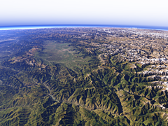
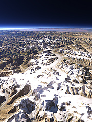
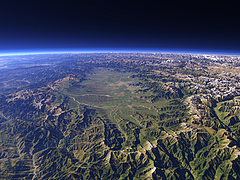
Kashmir and the western Himalayas
View of the Kashmir Valley and the western part of the Himalaya mountains with the Chenab River in the foreground.
| view data | |
|---|---|
| Location: | 75.881° E, 32.577° N |
| Altitude: | 51.863 km |
| View Direction: | 336° |
| Camera Angle: | 59° |
| Available size: | up to 8000×6000 pixel |
The western end of the Himalayas
View of the westmost part of the Himalaya mountains north of the Kashmir Valley with the Nanga Parbat in the center background, the Deosai plateau to the right and the Indus valley behind.
| view data | |
|---|---|
| Location: | 75.531° E, 33.857° N |
| Altitude: | 51.863 km |
| View Direction: | 330° |
| Camera Angle: | 62° |
| Available size: | up to 6000×8000 pixel |
The top of the Karakoram
View of the highest part of the Karakoram mountains with the upper Siachen Glacier on the foreground right, the Baltoro Glacier behind on the left and the Shaksgam River valley further to the right.
| view data | |
|---|---|
| Location: | 76.945° E, 35.331° N |
| Altitude: | 21.863 km |
| View Direction: | 342° |
| Camera Angle: | 47° |
| Available size: | up to 6000×8000 pixel |
The Hunza Valley from south
View of the Hunza Valley from the confluence of the Hunza River with the Gilgit River northwards with the Western Karakoram mountains on the right, the Pamir Plateau on the background left and the western Taklamakan Desert on the far right background.
| view data | |
|---|---|
| Location: | 74.114° E, 35.642° N |
| Altitude: | 35.863 km |
| View Direction: | 32° |
| Camera Angle: | 60° |
| Available size: | up to 6400×4800 pixel |
The Fedchenko Glacier
View of the Fedchenko Glacier in the northern Pamir from south with the Fergana Valley in the far background.
| view data | |
|---|---|
| Location: | 72.461° E, 38.407° N |
| Altitude: | 21.863 km |
| View Direction: | 330° |
| Camera Angle: | 62° |
| Available size: | up to 4800×6400 pixel |
The Tian Shan
View of the Tian Shan at the northern side of the Tarim Basin on the foreground left with the Issyk-Kul lake in the background.
| view data | |
|---|---|
| Location: | 82.047° E, 41.097° N |
| Altitude: | 51.863 km |
| View Direction: | 288.5° |
| Camera Angle: | 38° |
| Available size: | up to 9600×5400 pixel |
Kashgar and the Kongur Shan
View westward from Kashgar in the foreground right with the Kongur Shan mountains on the left towards the Tajikistan and Kyrgyzstan border with the Pamir on the background left and the Fergana Valley on the far right.
| view data | |
|---|---|
| Location: | 77.145° E, 38.729° N |
| Altitude: | 51.863 km |
| View Direction: | 286.5° |
| Camera Angle: | 50° |
| Available size: | up to 9600×5400 pixel |
The Kongur Shan
View of the Kongur Shan mountains and Muztagh Ata in the center and the Pamir with Karakul Lake on the left.
| view data | |
|---|---|
| Location: | 76.423° E, 37.465° N |
| Altitude: | 51.863 km |
| View Direction: | 307° |
| Camera Angle: | 45° |
| Available size: | up to 8000×6000 pixel |
From Karakoam towards Hindu Kush
View from the western end of the Karakoam mountains towards Hindu Kush and Pamir with the Hunza Valley crossing the center of the image
| view data | |
|---|---|
| Location: | 75.044° E, 35.748° N |
| Altitude: | 35.863 km |
| View Direction: | 319.4° |
| Camera Angle: | 64° |
| Available size: | up to 6000×8000 pixel |
The western Karakoram
View of the western part of the Karakoram mountains with the three main glaciers draining to the south, the Baltoro Glacier, the Biafo Glacier and the Hispar glacier on the left side and the Pamir plateau in the background.
| view data | |
|---|---|
| Location: | 76.691° E, 35.512° N |
| Altitude: | 51.863 km |
| View Direction: | 314° |
| Camera Angle: | 60° |
| Available size: | up to 6000×8000 pixel |
The K2
View of the K2 in the Karakoram as well at the rest of the highest part of the mountains with the Godwin-Austen Glacier and the Baltoro Glacier in the foreground
| view data | |
|---|---|
| Location: | 76.565° E, 35.538° N |
| Altitude: | 11.863 km |
| View Direction: | 358° |
| Camera Angle: | 47° |
| Available size: | up to 8000×6000 pixel |
The Hunza Valley
View of the central part of the Hunza Valley towards Attabad Lake with the Hispar Glacier and the higher Karakoram mountains on the right.
| view data | |
|---|---|
| Location: | 74.082° E, 36.129° N |
| Altitude: | 31.863 km |
| View Direction: | 72° |
| Camera Angle: | 58° |
| Available size: | up to 6300×8400 pixel |
The Kashmir Valley
View of the Kashmir Valley from the southeast. Uses waterbody data copyright OpenStreetMap contributors.
| view data | |
|---|---|
| Location: | 75.765° E, 32.992° N |
| Altitude: | 35.863 km |
| View Direction: | 322° |
| Camera Angle: | 57° |
| Available size: | up to 9600×7200 pixel |
Blog news:
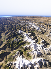
Todays featured image:

