Imagico.de
Geovisualizations
by Christoph Hormann
Fort Providence and Mackenzie River in Autumn 2022
View information

Sentinel-2 image of the Mackenzie River near Fort Providence, Northwest Territories, Canada in autumn 2022 with fall colors.
| view data | |
|---|---|
| Location: | 117.55° W, 61.29° N |
| Altitude: | 786 km |
| View Direction: | 0° |
| Camera Angle: | 0° |
| Available size: | up to 12778×7563 pixel |
License inquiry
Blog news:
The current state of map design in OpenStreetMap (18 Apr 2024)
Digital map design history (16 Apr 2024)
Addresses and Entrances (11 Apr 2024)
More Antarctic images for mapping (18 Mar 2024)
Todays featured image:
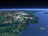
Southern Alaska from southwest
View of the southern part of Alaska from southwest with Augustine Island, Mount Redoubt and the Cook Inlet. [more]
The most important sections:
Design and Content Copyright 2024 by Christoph Hormann
last updated Sat, 30 Mar 2024 23:52