Imagico.de
Geovisualizations
by Christoph Hormann
The South Sandwich Islands in late Winter
View information

Landsat mosaic of the South Sandwich Islands in late winter 2014 including Southern Thule, Bristol, Montagu, Saunders and Candlemas Islands as well as Visokoi Island, the latter mostly covered by clouds. The ocean shows extensive sea ice coverage as well as various icebergs well visible in the low sun.
| view data | |
|---|---|
| Location: | 27° W, 58° S |
| Altitude: | 700 km |
| View Direction: | 0° |
| Camera Angle: | 0° |
| Available size: | up to 13000×22600 pixel |
License inquiry
Blog news:
Trends for the future of map design in OpenStreetMap (20 Apr 2024)
The current state of map design in OpenStreetMap (18 Apr 2024)
Digital map design history (16 Apr 2024)
Addresses and Entrances (11 Apr 2024)
Todays featured image:
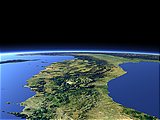
Northern Italy
View of Italy northward from Naples with the Alps in the far background [more]
The most important sections:
Design and Content Copyright 2024 by Christoph Hormann
last updated Sat, 30 Mar 2024 23:52