Imagico.de
Geovisualizations
by Christoph Hormann
Severnaya Zemlya in early Spring 2016
View information

Landsat mosaic of Severnaya Zemlya from late March/early April 2016 with the islands nearly fully snow covered, land fast sea ice between and around the islands and pack ice around on the Kara Sea and the Laptev Sea.
| view data | |
|---|---|
| Location: | 97° E, 79.6° N |
| Altitude: | 700 km |
| View Direction: | 0° |
| Camera Angle: | 0° |
| Available size: | up to 24000×28000 pixel |
License inquiry
Blog news:
The current state of map design in OpenStreetMap (18 Apr 2024)
Digital map design history (16 Apr 2024)
Addresses and Entrances (11 Apr 2024)
More Antarctic images for mapping (18 Mar 2024)
Todays featured image:
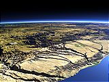
The coast of southern Peru
Showing the Canyons in the Andes mountains at the Pacific coast of southern Peru. [more]
The most important sections:
Design and Content Copyright 2024 by Christoph Hormann
last updated Sat, 30 Mar 2024 23:52