Imagico.de
3d image types and variants
The 3d views i offer are created using computer rendering methods (raytracing) from a digital description of geometry, surface properties and colors as well as illumination.
Standard views
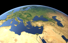
These views similar in style to most of the Views of the Earth show the earth surface with realistic geometry and coloring while eliminating the clouds that would usually be present in a photograph and reducing the density of the atmosphere significantly in comparison to nature. This way i create an impression comparable to that from close distance in nature while the perspective of the view is that of a more distant observer.
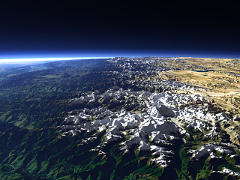
These Images can produced according to individual requirements with a standpoint directly on the earth surface, for example on some mountain peak or from higher up to a height of many thousand kilometers. Even points that are usually not accessible for a photograph, for example at altitudes in the range of 50 bis 100 km can be used without problems.
Views without horizon
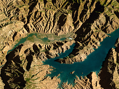
Of course these images can also be produced with a steeper viewing angle so the horizon is not visible in the image. This can be used even to produce a map like image with viewing direction directly from above.
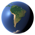
Whole planet views
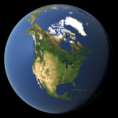
If it is required to depict large parts of the earth surface in a single view it is most often useful to show the whole planet. Apart from the direction from which the earth is shown the illumination can be adjusted to represent a certain daytime and date and the surface colors can show the seasonal change with varying amounts of snow and the development of the vegetation. One example of using this technique are the die Sea ice coverage images at the Views of the Earth.
Special perspectives
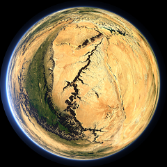
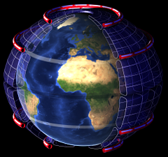
Apart from normal linear perspective views i also produce special perspectives like the fisheye view on the left. This allows compact display of contexts that could otherwise not be shown or at least not in a single image.
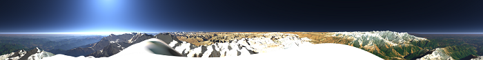
Panoramas
One special perspective are 360 degree panoramas which are well suited to illustrate the view from special points like mountain peaks or lookout points (see example below). But they also offer an interesting perspective from higher altitudes. Some examples can be found among the Views of the Earth.
Marks and labels
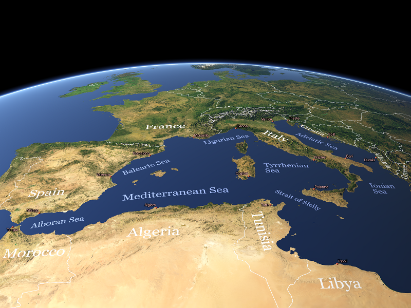
All views can be supplemented with markings and labels. The first example on the left shows how this can be used to label sites and areas. The large size version of this example is provided under Creative Commons Attribution-ShareAlike License. The second example demonstrates the possibilities to illustrate more complex issues, in this case the pattern of global circulation in the earth atmosphere. In similar manner also commodity flows, organization structures or other geographic relations can be visualized.
The marks and labels can be provided as separate layers to allow for the possibility to edit the underlying earth visualization independently. Labels can also be produced as vector files.


Blog news:
Todays featured image: