Template:TagInfoBox
Jump to navigation
Jump to search
Template to display the right side info box on a tag page. Like:
2022-01-27 natural=water |
|||
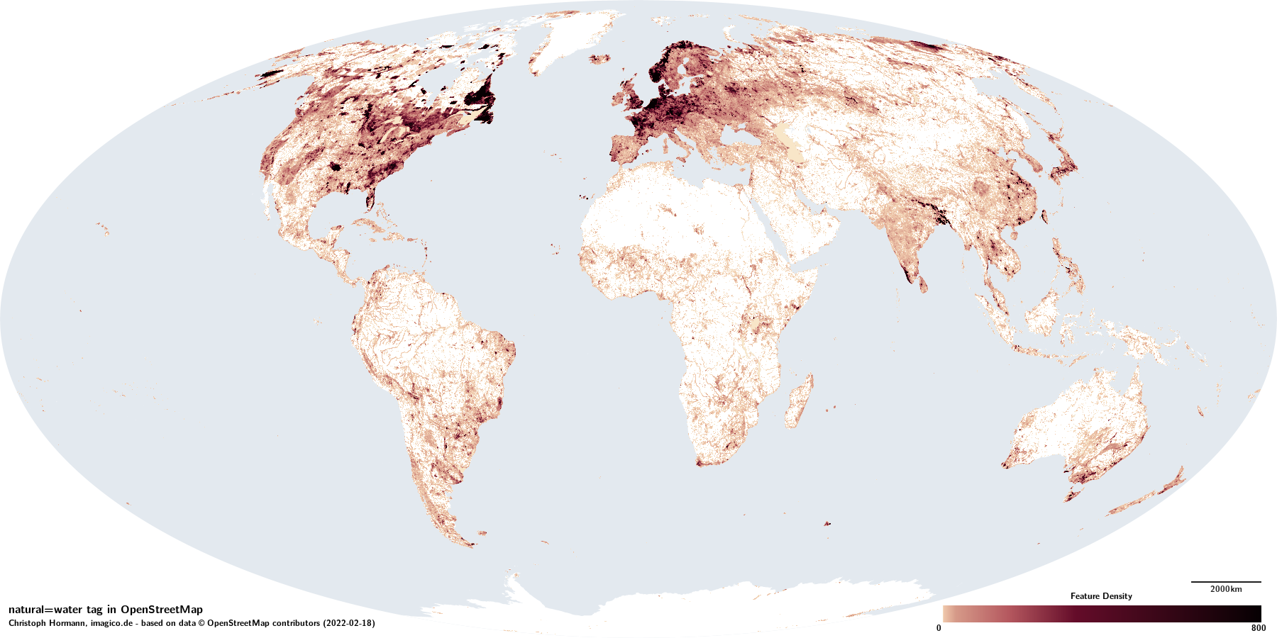 | |||
| Permanently or regularly water covered part of the Earth surface | |||
| Hydrography Physical Geography | |||
| Tag level ⓘ | primary | ||
| Tag type ⓘ | discrete | ||
| Geometry conventions ⓘ | mixed | ||
| Data quality and volume | |||
|---|---|---|---|
| Consistency: | + | ྾ | ~ |
| Verifiability: | − | 🞼 | 🞼 |
| Geometric accuracy: | good | ||
| Completeness: | good | ||
| Feature count: ⓘ | 15.2k | 582k | |
| Number of nodes: ⓘ | 15.2k | 9.34M | 119k |
| Nodes per feature: ⓘ | – | 16 | 38 |
| Average segment length: ⓘ | – | 34m | 30m |
| Total size (in km/km²): ⓘ | – | 312k | 1.38k |
| Taginfo numbers and trends | |||
| Counts: ⓘ | 15.2k | 591k | 267 |
| 30 days trend: ⓘ | -9 | 8.65k | 0 |
| ⮡ Percent: ⓘ | -0.07 | 1.46 | -0.37 |