Kanyakumari/Cape Comorin
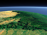
The southmost point of the Indian Peninsula marks the end of the Western Ghats mountain range that continues north parallel to the west coast on the left of this view. The historic town Calicut that has been a trade center for spices and other products of India and East Asia since medieval times is located in the far background.
| View: | Kanyakumari/Cape Comorin |
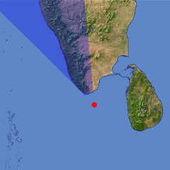
| Location: | Lon 77.933° Lat 7.415° |
| Altitude: | 39 km |
| Direction: | 335° |
| Camera Angle: | 39° |
| User Rating: | 2.5 |
Location Map: Visible Topography

Home •
Impressum •
Terms •
Sitemap •
Browse:
list
/
map /
gallery •

imagico.de • blog.imagico.de • services.imagico.de • maps.imagico.de • earth.imagico.de • photolog.imagico.de
imagico.de • blog.imagico.de • services.imagico.de • maps.imagico.de • earth.imagico.de • photolog.imagico.de


Visitor comments:
By submitting your comment you agree to the privacy policy and agree to the information you provide (except for the email address) to be published on this website.