The Hohe Tauern
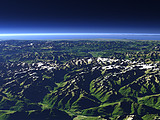
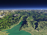
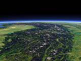
The Hohe Tauern is the highest part of the Eastern Alps and contains the Großglockner (3798m), the highest peak in Austria. This view from the east shows in the foreground the Glockner Group and the Granatspitz Group and behind, separated by the Felber Tauern pass the Venediger Group.
| Ansicht: | The Hohe Tauern |
| Position: | Lon 13.279° Lat 47.029° |
| Höhe: | 13 km |
| Richtung: | 280° |
| Kamerawinkel: | 26° |
| Bewertung: | 2.3 |
Umgebungskarte: Optisch Topographie

Start •
Impressum •
Nutzungsbedingungen •
Sitemap •
Bilder:
Liste
/
Karte /
Galerie •

imagico.de • blog.imagico.de • services.imagico.de • maps.imagico.de • earth.imagico.de • photolog.imagico.de
imagico.de • blog.imagico.de • services.imagico.de • maps.imagico.de • earth.imagico.de • photolog.imagico.de


Kommentare:
noch keine Kommentare.
Durch das Abschicken Ihres Kommentars stimmen Sie der Datenschutzrichtlinie zu und erlauben, dass die eingegebenen Informationen (mit Ausnahme der eMail-Adresse) in diesem Blog veröffentlicht werden.