Views of the Earth

artificial images of our real planet
Canary Islands 1 location map

Canary Islands 1

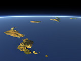
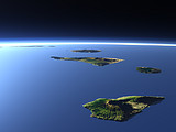
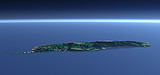
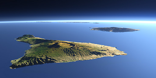
The Canary Islands are a group of islands of volcanic origin near the north African coast. In the foreground there is Tenerife with the highest peak, the Pico de Teide (3718 m), behind Gran Canaria and in the background Fuerteventura and Lanzarote.

View: Canary Islands 1
Location: Lon -17.479°
Lat 28.113°
Altitude: 19 km
Direction: 85°
Camera Angle: 45°
User Rating: 2.4
Location Map:    Visible Topography
Canary Islands 1 location map
Canary Islands 1

Related Views:

Canary Islands 2
Canary Islands 3
Madeira

Visitor comments:

by maxsommer from Spain posted on Sun Apr 6 2008 15:49:03
Hallo Christoph\\r\\nSchoenen Sonntag und beste Gruesse von Tenerife.\\r\\nDeine Bilder sind absolute Klasse!\\r\\nAlles Beste max
Leave a comment
You have to enable Javascript to be able to write comments.
human verification Please enter the code you can see in the image on the left to verify you are a human and not a spamming script.
* * Required field
Information about you
*
will not be made public
will be displayed with your posting
Your comment (no HTML)

*

If you want to send a private message to the author of this website you can do so via Email.

The comments will be reviewed before they are added to the site. So you might need to wait some time until your entry turns up.

Please note this comment function is intended for commenting on the text and images, not for discussing political or religious views. Comments with no relation to the content of this site will not be approved.

By submitting your comment you agree to the privacy policy and agree to the information you provide (except for the email address) to be published on this website.

  
Design and Content Copyright 2023 by Christoph Hormann
last updated Sun, 16 Jul 2023 20:38