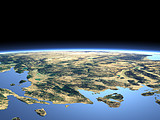
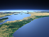
The Sea of Marmara
Between the Bosporus (background) and the Dardanelles (foreground) lies the Sea of Marmara connecting the Black sea to the Mediterranean Sea and marking the border between Asia and Europe. South of the Sea of Marmara the lakes Kuş Gölü Ulubat Gölü İznik Gölü and Sapanca Gölü can be seen.
| View: | The Sea of Marmara |
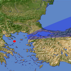
| Location: | Lon 24.259° Lat 39.631° |
| Altitude: | 59 km |
| Direction: | 72° |
| Camera Angle: | 24° |
| User Rating: | 2.6 |
Location Map: Visible Topography

Home •
Impressum •
Terms •
Sitemap •
Browse:
list
/
map /
gallery •

imagico.de • blog.imagico.de • services.imagico.de • maps.imagico.de • earth.imagico.de • photolog.imagico.de
imagico.de • blog.imagico.de • services.imagico.de • maps.imagico.de • earth.imagico.de • photolog.imagico.de


Visitor comments:
By submitting your comment you agree to the privacy policy and agree to the information you provide (except for the email address) to be published on this website.