Simplified OpenStreetMap boundaries download
Here you can download simplified administrative boundaries from OpenStreetMap for use in map rendering. A sample rendering of these can be found on maps.imagico.de.
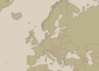
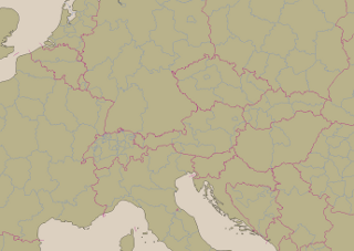
These packages contain shapefiles in web mercator (EPSG:3857) projection intended for use in web maps at zoom levels 2-8. They have been produced exclusively from OpenStreetMap data. The maritime boundaries are only included where they are necessary to indicate what country a certain island belongs to.

|

|
| admin_level 2 boundaries for z=4 | admin_level 2+4 boundaries for z=6 |
The exact degree of simplification used for showing boundaries depends on the style of a map so you might need to use these files with an offset in zoom levels.
These files are made available under the Creative Commons Attribution-ShareAlike 4.0 license. Data source is © OpenStreetMap contributors. Some might wonder why these are not licensed under ODBL like the original OSM data - this is because the simplified boundaries are a rendering of the data and it is neither intended nor possible to extract the actual boundary data from it. Therefore it is a produced work in terms of the ODBL.
Current version from December 13, 2014: Using OSM data from 2014-12-05, files in subdirectory 'osm' within zip, date included in readme.
- boundaries_osm_2.zip (3271kB) - national boundaries for zoom levels 2-8
- boundaries_osm_4.zip (2158kB) - admin_level 2 and 4 boundaries for zoom level 6 (experimental)


Visitor comments:
no comments yet.
By submitting your comment you agree to the privacy policy and agree to the information you provide (except for the email address) to be published on this website.