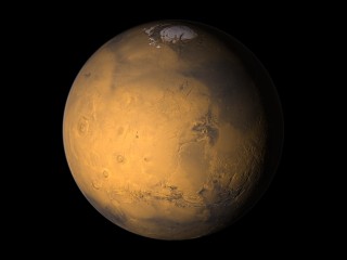
Rendering mars
The geometry data used for these render can be found at the
![]() MOLA Data products site.
MOLA Data products site.
The resolution of the data available there is 128 points per degree This results in 46080x22528 points for the whole planet, the last two degrees of latitude at the poles are missing in the highest resolution and where filled with lower resolution data.
When rendering the whole planet the render is split into several parts each only rendering a tile like explained on the main planets rendering page.
The coloring uses a much lower resulution map based on
an image from the Viking probes that is available on
![]() Calvin J. Hamilton's site.
Calvin J. Hamilton's site.
The image had to be processed to remove the shading and looses even more detail this way.

|

|
With the data mentioned above it is possible to render the planet at very large size, the detail view on the right is from a 6400x4800 render.
A topographic map showing the characteristic features of the mars surface can be found on
![]() http://geopubs.wr.usgs.gov/open-file/of02-282/
http://geopubs.wr.usgs.gov/open-file/of02-282/
|
polar region with craters |

|
|
Valles Marineris |

|


