Yigong Tsangpo and Palung Tsangpo
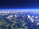
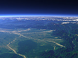
The Yigong Tsangpo (from background) and Palung Tsangpo (from foreground) together form a straight long valley flanking the eastern end of the Himalaya. In the center left of this view they cross through the mountains to join the Yarlung Tsangpo from the west to later form the Bramaputra.
| View: | Yigong Tsangpo and Palung Tsangpo |
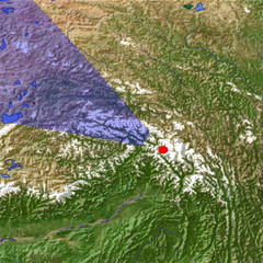
| Location: | Lon 96.389° Lat 29.502° |
| Altitude: | 39 km |
| Direction: | 303° |
| Camera Angle: | 42° |
| User Rating: | 3.4 |
Location Map: Visible Topography

Home •
Impressum •
Terms •
Sitemap •
Browse:
list
/
map /
gallery •

imagico.de • blog.imagico.de • services.imagico.de • maps.imagico.de • earth.imagico.de • photolog.imagico.de
imagico.de • blog.imagico.de • services.imagico.de • maps.imagico.de • earth.imagico.de • photolog.imagico.de


Visitor comments:
no comments yet.
By submitting your comment you agree to the privacy policy and agree to the information you provide (except for the email address) to be published on this website.