Imagico.de
Geovisualizations
by Christoph Hormann


Fort Providence and Mackenzie River in Autumn 2022
View information

Sentinel-2 image of the Mackenzie River near Fort Providence, Northwest Territories, Canada in autumn 2022 with fall colors.
| view data | |
|---|---|
| Location: | 117.55° W, 61.29° N |
| Altitude: | 786 km |
| View Direction: | 0° |
| Camera Angle: | 0° |
| Available size: | up to 12778×7563 pixel |
License inquiry
Blog news:
More map symbols (01 Nov 2024)
Is the OSMF not overly fond of OpenStreetMap? (25 Oct 2024)
Point barriers (23 Oct 2024)
A few additional comments on the new OSM-Carto release (17 Oct 2024)
Todays featured image:
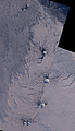
The South Sandwich Islands in late Winter
Landsat mosaic of the South Sandwich Islands in late winter 2014 including Southern Thule, Bristol, Montagu, Saunders and Candlemas Islands as well... [more]
The most important sections:

Design and Content Copyright 2024 by Christoph Hormann
last updated Sat, 30 Mar 2024 23:52