Imagico.de
Geovisualizations
by Christoph Hormann
The Hunza Valley from south
View information

View of the Hunza Valley from the confluence of the Hunza River with the Gilgit River northwards with the Western Karakoram mountains on the right, the Pamir Plateau on the background left and the western Taklamakan Desert on the far right background.
| view data | |
|---|---|
| Location: | 74.114° E, 35.642° N |
| Altitude: | 35.863 km |
| View Direction: | 32° |
| Camera Angle: | 60° |
| Available size: | up to 6400×4800 pixel |
License inquiry
Blog news:
More map symbols (01 Nov 2024)
Is the OSMF not overly fond of OpenStreetMap? (25 Oct 2024)
Point barriers (23 Oct 2024)
A few additional comments on the new OSM-Carto release (17 Oct 2024)
Todays featured image:
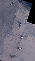
The South Sandwich Islands in late Winter
Landsat mosaic of the South Sandwich Islands in late winter 2014 including Southern Thule, Bristol, Montagu, Saunders and Candlemas Islands as well... [more]
The most important sections:
Design and Content Copyright 2024 by Christoph Hormann
last updated Sat, 30 Mar 2024 23:52