Imagico.de
Geovisualizations
by Christoph Hormann


The western end of the Himalayas
View information
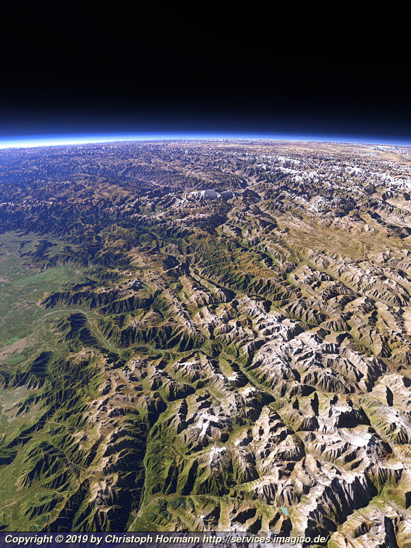
View of the westmost part of the Himalaya mountains north of the Kashmir Valley with the Nanga Parbat in the center background, the Deosai plateau to the right and the Indus valley behind.
| view data | |
|---|---|
| Location: | 75.531° E, 33.857° N |
| Altitude: | 51.863 km |
| View Direction: | 330° |
| Camera Angle: | 62° |
| Available size: | up to 6000×8000 pixel |
License inquiry
Blog news:
Trends for the future of map design in OpenStreetMap (20 Apr 2024)
The current state of map design in OpenStreetMap (18 Apr 2024)
Digital map design history (16 Apr 2024)
Addresses and Entrances (11 Apr 2024)
Todays featured image:
Western Himalaya with Lake Manasarovar and Mount Kailash
View of the Western Himalaya with Lake Manasarovar on the Tibetean Plateau and Mount Kailash on the far right [more]
The most important sections:

Design and Content Copyright 2024 by Christoph Hormann
last updated Sat, 30 Mar 2024 23:52