Imagico.de
New views
The following ? have been newly added to the catalog recently.
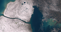
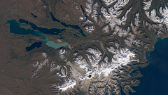
Nettilling Lake in early October 2022
Landsat image of Nettilling Lake in early October 2022 with fresh snow.
| view data | |
|---|---|
| Location: | 71.6° W, 66.6° N |
| Altitude: | 700 km |
| View Direction: | 0° |
| Camera Angle: | 0° |
| Available size: | up to 11166×5956 pixel |
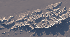
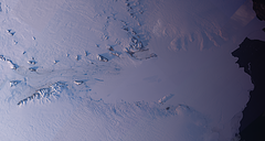
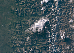
Ellsworth Mountains in late September 2022
Landsat image of the Ellsworth Mountains in late September 2022.
| view data | |
|---|---|
| Location: | 85.74° W, 78.41° S |
| Altitude: | 700 km |
| View Direction: | 0° |
| Camera Angle: | 0° |
| Available size: | up to 8746×4687 pixel |
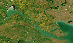
Fort Providence and Mackenzie River in Autumn 2022
Sentinel-2 image of the Mackenzie River near Fort Providence, Northwest Territories, Canada in autumn 2022 with fall colors.
| view data | |
|---|---|
| Location: | 117.55° W, 61.29° N |
| Altitude: | 786 km |
| View Direction: | 0° |
| Camera Angle: | 0° |
| Available size: | up to 12778×7563 pixel |
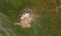
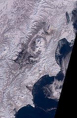
Shiveluch, Kamchatka in Autumn 2022
Sentinel-2 image of the Shiveluch volcano in Kamchatka, Russia in autumn 2022.
| view data | |
|---|---|
| Location: | 161.37° E, 56.66° N |
| Altitude: | 786 km |
| View Direction: | 0° |
| Camera Angle: | 0° |
| Available size: | up to 7443×4406 pixel |
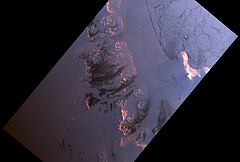
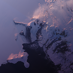
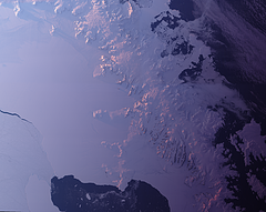
Antarctic sunrise 2021
Landsat image of McMurdo sound and dry valleys in the Antarctic from early September 2021 with very low sun position to the northeast marking the beginning of the 2021/2022 observation season.
| view data | |
|---|---|
| Location: | 162° E, 77.7° S |
| Altitude: | 700 km |
| View Direction: | 0° |
| Camera Angle: | 0° |
| Available size: | up to 25753×17362 pixel |
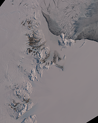
Antarctic spring 2021
Sentinel-2 mosaic of McMurdo sound and dry valleys and the Transantarctic mountain south until Byrd glacier from early in the 2021/2022 observation season in October 2021 with the Ross sea largely covered with sea ice.
| view data | |
|---|---|
| Location: | 163° E, 78.6° S |
| Altitude: | 786 km |
| View Direction: | 0° |
| Camera Angle: | 0° |
| Available size: | up to 43824×54712 pixel |
Mount Katmai and Naknek Lake
Landsat image of Mount Katmai and Naknek Lake on the Alaska Peninsula in autumn 2021 with some fresh snow at higher elevations.
| view data | |
|---|---|
| Location: | 155.33° W, 58.437° N |
| Altitude: | 700 km |
| View Direction: | 0° |
| Camera Angle: | 0° |
| Available size: | up to 10886×6120 pixel |
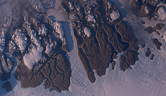
Northern Greenland in Autumn 2021
Landsat image of Wulff Land and Warming Land in Northern Greenland with low sun from the southwest.
| view data | |
|---|---|
| Location: | 49.988° W, 81.656° N |
| Altitude: | 700 km |
| View Direction: | 0° |
| Camera Angle: | 0° |
| Available size: | up to 12060×6988 pixel |
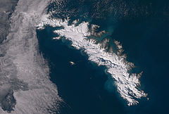
South Georgia in early Spring 2021
Sentinel-2 image of South Georgia at the beginning of the 2021-2022 summer season with cloud cover only in the northwest.
| view data | |
|---|---|
| Location: | 36.72° W, 54.29° S |
| Altitude: | 786 km |
| View Direction: | 0° |
| Camera Angle: | 0° |
| Available size: | up to 18200×12300 pixel |
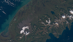
Mount Aniakchak in Autumn 2021
Sentinel-2 image of Mount Aniakchak and Mount Chiginagak on the Alaska Peninsula in autumn 2021 with some fresh snow at higher elevations.
| view data | |
|---|---|
| Location: | 157.9° W, 57° N |
| Altitude: | 786 km |
| View Direction: | 0° |
| Camera Angle: | 0° |
| Available size: | up to 13600×7900 pixel |
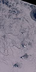
South Sandwich Islands in Winter 2020
Almost cloud free Sentinel-2 mosaic of the South Sandwich Islands in Winter 2020 showing sea ice reaching very far northward beyond Zavodovski Island
| view data | |
|---|---|
| Location: | 27° W, 58° S |
| Altitude: | 786 km |
| View Direction: | 0° |
| Camera Angle: | 0° |
| Available size: | up to 20000×40000 pixel |
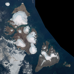
Severnaya Zemlya in August 2020
Cloud free Sentinel-2 mosaic of Severnaya Zemlya in August 2020 featuring an almost ice free Laptev Sea while there is some drift ice remaining on the eastern Kara Sea.
| view data | |
|---|---|
| Location: | 97° E, 79.6° N |
| Altitude: | 786 km |
| View Direction: | 0° |
| Camera Angle: | 0° |
| Available size: | up to 40000×40000 pixel |
The Deosai plateau
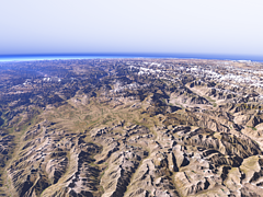
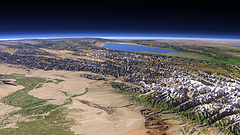
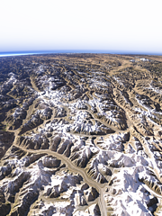
View of the Deosai plateau from the east with the upper Indus valley to the right and the Nanga Parbat on the background left.
| view data | |
|---|---|
| Location: | 76.004° E, 34.539° N |
| Altitude: | 31.863 km |
| View Direction: | 322° |
| Camera Angle: | 66° |
| Available size: | up to 8000×6000 pixel |
The Nanga Parbat
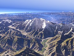
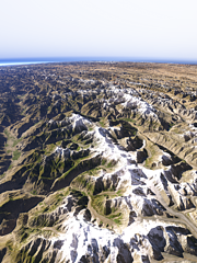
Closeup view of the Nanga Parbat from east with the Rupal Glacier, Bazhin Glacier and Chhungphar Glacier visible.
| view data | |
|---|---|
| Location: | 75.08° E, 35.156° N |
| Altitude: | 11.863 km |
| View Direction: | 282° |
| Camera Angle: | 32° |
| Available size: | up to 8000×6000 pixel |
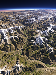
The Indus and Shyok Rivers
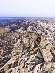
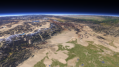
View westwards down the upper Indus on the left and the Shyok River on the right south of the Karakoram mountains and with the Shigar River and the Skardu Valley in the center back and the Nanga Parbat on the far left.
| view data | |
|---|---|
| Location: | 76.403° E, 34.976° N |
| Altitude: | 31.863 km |
| View Direction: | 309° |
| Camera Angle: | 64° |
| Available size: | up to 6000×8000 pixel |
Kashmir and the western Himalayas
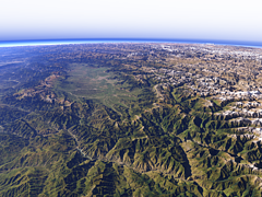
View of the Kashmir Valley and the western part of the Himalaya mountains with the Chenab River in the foreground.
| view data | |
|---|---|
| Location: | 75.881° E, 32.577° N |
| Altitude: | 51.863 km |
| View Direction: | 336° |
| Camera Angle: | 59° |
| Available size: | up to 8000×6000 pixel |
The western end of the Himalayas
View of the westmost part of the Himalaya mountains north of the Kashmir Valley with the Nanga Parbat in the center background, the Deosai plateau to the right and the Indus valley behind.
| view data | |
|---|---|
| Location: | 75.531° E, 33.857° N |
| Altitude: | 51.863 km |
| View Direction: | 330° |
| Camera Angle: | 62° |
| Available size: | up to 6000×8000 pixel |
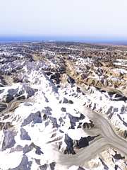
The top of the Karakoram
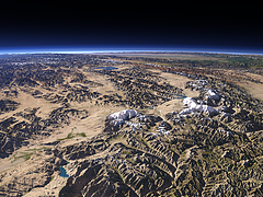
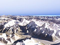
View of the highest part of the Karakoram mountains with the upper Siachen Glacier on the foreground right, the Baltoro Glacier behind on the left and the Shaksgam River valley further to the right.
| view data | |
|---|---|
| Location: | 76.945° E, 35.331° N |
| Altitude: | 21.863 km |
| View Direction: | 342° |
| Camera Angle: | 47° |
| Available size: | up to 6000×8000 pixel |
The Hunza Valley from south
View of the Hunza Valley from the confluence of the Hunza River with the Gilgit River northwards with the Western Karakoram mountains on the right, the Pamir Plateau on the background left and the western Taklamakan Desert on the far right background.
| view data | |
|---|---|
| Location: | 74.114° E, 35.642° N |
| Altitude: | 35.863 km |
| View Direction: | 32° |
| Camera Angle: | 60° |
| Available size: | up to 6400×4800 pixel |
The Fedchenko Glacier
View of the Fedchenko Glacier in the northern Pamir from south with the Fergana Valley in the far background.
| view data | |
|---|---|
| Location: | 72.461° E, 38.407° N |
| Altitude: | 21.863 km |
| View Direction: | 330° |
| Camera Angle: | 62° |
| Available size: | up to 4800×6400 pixel |
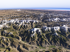
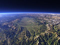
The Tian Shan
View of the Tian Shan at the northern side of the Tarim Basin on the foreground left with the Issyk-Kul lake in the background.
| view data | |
|---|---|
| Location: | 82.047° E, 41.097° N |
| Altitude: | 51.863 km |
| View Direction: | 288.5° |
| Camera Angle: | 38° |
| Available size: | up to 9600×5400 pixel |
Kashgar and the Kongur Shan
View westward from Kashgar in the foreground right with the Kongur Shan mountains on the left towards the Tajikistan and Kyrgyzstan border with the Pamir on the background left and the Fergana Valley on the far right.
| view data | |
|---|---|
| Location: | 77.145° E, 38.729° N |
| Altitude: | 51.863 km |
| View Direction: | 286.5° |
| Camera Angle: | 50° |
| Available size: | up to 9600×5400 pixel |
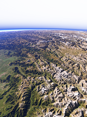
The Kongur Shan
View of the Kongur Shan mountains and Muztagh Ata in the center and the Pamir with Karakul Lake on the left.
| view data | |
|---|---|
| Location: | 76.423° E, 37.465° N |
| Altitude: | 51.863 km |
| View Direction: | 307° |
| Camera Angle: | 45° |
| Available size: | up to 8000×6000 pixel |
From Karakoam towards Hindu Kush
View from the western end of the Karakoam mountains towards Hindu Kush and Pamir with the Hunza Valley crossing the center of the image
| view data | |
|---|---|
| Location: | 75.044° E, 35.748° N |
| Altitude: | 35.863 km |
| View Direction: | 319.4° |
| Camera Angle: | 64° |
| Available size: | up to 6000×8000 pixel |
The western Karakoram
View of the western part of the Karakoram mountains with the three main glaciers draining to the south, the Baltoro Glacier, the Biafo Glacier and the Hispar glacier on the left side and the Pamir plateau in the background.
| view data | |
|---|---|
| Location: | 76.691° E, 35.512° N |
| Altitude: | 51.863 km |
| View Direction: | 314° |
| Camera Angle: | 60° |
| Available size: | up to 6000×8000 pixel |
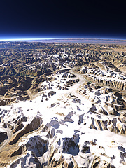
The K2
View of the K2 in the Karakoram as well at the rest of the highest part of the mountains with the Godwin-Austen Glacier and the Baltoro Glacier in the foreground
| view data | |
|---|---|
| Location: | 76.565° E, 35.538° N |
| Altitude: | 11.863 km |
| View Direction: | 358° |
| Camera Angle: | 47° |
| Available size: | up to 8000×6000 pixel |
Algae bloom off the outer Outer Hebrides
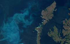
Sentinel-2 image showing algae bloom off the outer Outer Hebrides in Scotland around St. Kilda in Summer 2019.
| view data | |
|---|---|
| Location: | 7° W, 58° N |
| Altitude: | 786 km |
| View Direction: | 0° |
| Camera Angle: | 0° |
| Available size: | up to 25721×16217 pixel |
Last ice thawing in northern Canada 2019
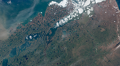
Sentinel-2 image of the coast of northern Canada east of the Mackenzie River delta in June 2019 with the Tuktoyaktuk Peninsula and the Husky Lakes/Eskimo Lakes.
| view data | |
|---|---|
| Location: | 132° W, 69.6° N |
| Altitude: | 786 km |
| View Direction: | 0° |
| Camera Angle: | 0° |
| Available size: | up to 25548×14210 pixel |
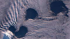
Clouds around Heard Island in Winter 2019
Sentinel-2 image of cloud vortices northeast of Heard Island near mid winter 2019.
| view data | |
|---|---|
| Location: | 73.6° E, 53° S |
| Altitude: | 786 km |
| View Direction: | 0° |
| Camera Angle: | 0° |
| Available size: | up to 11729×6523 pixel |
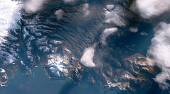
Winter 2019 on Kerguelen
Sentinel-2 image showing a glimpse of the Kerguelen Islands between the clouds in Winter 2019.
| view data | |
|---|---|
| Location: | 69.5° E, 49.5° S |
| Altitude: | 786 km |
| View Direction: | 0° |
| Camera Angle: | 0° |
| Available size: | up to 9827×5466 pixel |
The Hunza Valley
View of the central part of the Hunza Valley towards Attabad Lake with the Hispar Glacier and the higher Karakoram mountains on the right.
| view data | |
|---|---|
| Location: | 74.082° E, 36.129° N |
| Altitude: | 31.863 km |
| View Direction: | 72° |
| Camera Angle: | 58° |
| Available size: | up to 6300×8400 pixel |
The Kashmir Valley
View of the Kashmir Valley from the southeast. Uses waterbody data copyright OpenStreetMap contributors.
| view data | |
|---|---|
| Location: | 75.765° E, 32.992° N |
| Altitude: | 35.863 km |
| View Direction: | 322° |
| Camera Angle: | 57° |
| Available size: | up to 9600×7200 pixel |
Ross Island and McMurdo Sound
Nighttime Landsat mosaic of McMurdo Sound with Ross island on the lower left and the McMurdo Dry Valleys on the right. Sun is very low in the south.
| view data | |
|---|---|
| Location: | 166° E, 78° S |
| Altitude: | 700 km |
| View Direction: | 0° |
| Camera Angle: | 0° |
| Available size: | up to 16000×16000 pixel |
Lambert Glacier and Amery Ice Shelf
Nighttime Landsat mosaic of the Lambert Glacier and Amery Ice Shelf in eastern Antarctica in early 2019. Sun is coming from the south which is on the left.
| view data | |
|---|---|
| Location: | 68° E, 72° S |
| Altitude: | 700 km |
| View Direction: | 0° |
| Camera Angle: | 0° |
| Available size: | up to 45000×24000 pixel |
The Antarctic Peninsula at Night
Nighttime Landsat mosaic of the Antarctic Peninsula with North on the lower right.
| view data | |
|---|---|
| Location: | 63° W, 66.5° S |
| Altitude: | 700 km |
| View Direction: | 0° |
| Camera Angle: | 0° |
| Available size: | up to 27000×21500 pixel |
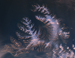
Winter Sunrise over the Westfjords, Iceland
Winter Landsat image from just after sunrise in early 2019 of the Westfjords in northwestern Iceland with relatively little snow.
| view data | |
|---|---|
| Location: | 22.5° W, 66° N |
| Altitude: | 700 km |
| View Direction: | 0° |
| Camera Angle: | 0° |
| Available size: | up to 10854×8496 pixel |
Kamchatka Volcanoes in February 2019
Landsat mosaic of the Kamchatka peninsula in February 2019 with activity of three different volcanoes simultaneously.
| view data | |
|---|---|
| Location: | 161° E, 55.5° N |
| Altitude: | 700 km |
| View Direction: | 0° |
| Camera Angle: | 0° |
| Available size: | up to 26000×40000 pixel |
Northern Greenland Autumn 2018
Landsat mosaic of Northern Greenland and Northern Ellesmere Island in late August/early September 2018. This includes the nearly cloud free September 2018 off nadir pass and matching scenes from further south.
| view data | |
|---|---|
| Location: | 60° W, 82° N |
| Altitude: | 700 km |
| View Direction: | 0° |
| Camera Angle: | 0° |
| Available size: | up to 86000×34000 pixel |
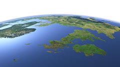
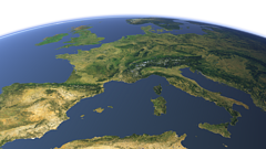
Europe from northwest
View of the central part of Europe from northwest reaching from southern Scandinavia to southern France with Great Britain and Ireland prominently in the foreground. Uses waterbody data copyright OpenStreetMap contributors.
| view data | |
|---|---|
| Location: | 29.007° W, 58.401° N |
| Altitude: | 1321.86 km |
| View Direction: | 108° |
| Camera Angle: | 45° |
| Available size: | up to 9600×5400 pixel |
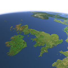
Great Britain and Ireland from southwest
View of View of Great Britain and Ireland from southwest. Uses waterbody data copyright OpenStreetMap contributors.
| view data | |
|---|---|
| Location: | 10.781° W, 44.021° N |
| Altitude: | 1021.86 km |
| View Direction: | 31° |
| Camera Angle: | 35° |
| Available size: | up to 6400×6400 pixel |
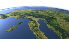
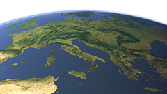
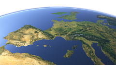
Central Europe from southeast
View of Central Europe from the southeast with the Alps in the middle, Italy in the foreground and France and Germany in the background. Uses waterbody data copyright OpenStreetMap contributors.
| view data | |
|---|---|
| Location: | 19.627° E, 33.353° N |
| Altitude: | 1021.86 km |
| View Direction: | 326° |
| Camera Angle: | 45° |
| Available size: | up to 9600×5400 pixel |
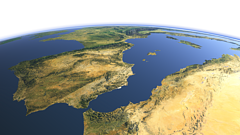
The western Mediterranean Sea
View of the western Mediterranean Sea from southwest with the Iberian peninsula on the left and North Africa on the foreground right. Uses waterbody data copyright OpenStreetMap contributors.
| view data | |
|---|---|
| Location: | 8.83° W, 27.299° N |
| Altitude: | 1021.86 km |
| View Direction: | 32° |
| Camera Angle: | 48° |
| Available size: | up to 9600×5400 pixel |
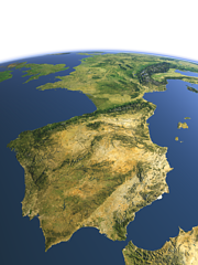
The Iberian peninsula
View of the Iberian peninsula from southwest with the Strait of Gibraltar in the foreground and France in the background. Uses waterbody data copyright OpenStreetMap contributors.
| view data | |
|---|---|
| Location: | 8.207° W, 34.028° N |
| Altitude: | 1021.86 km |
| View Direction: | 32.5° |
| Camera Angle: | 45° |
| Available size: | up to 7200×9600 pixel |
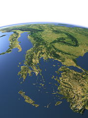
The Balkan Peninsula
View of the Balkan Peninsula from southeast with Greece, western Turkey and the Aegean Sea in the foreground. Uses waterbody data copyright OpenStreetMap contributors.
| view data | |
|---|---|
| Location: | 28.411° E, 32.889° N |
| Altitude: | 1021.86 km |
| View Direction: | 327° |
| Camera Angle: | 45° |
| Available size: | up to 7200×9600 pixel |
Eastern Europe from south
View of Eastern Europe from the south. Uses waterbody data copyright OpenStreetMap contributors.
| view data | |
|---|---|
| Location: | 14.945° E, 21.358° N |
| Altitude: | 2821.86 km |
| View Direction: | 359.5° |
| Camera Angle: | 36° |
| Available size: | up to 9600×5400 pixel |
Western Europe from south
View of Western Europe from the south. Uses waterbody data copyright OpenStreetMap contributors.
| view data | |
|---|---|
| Location: | 6.163° E, 22.298° N |
| Altitude: | 2821.86 km |
| View Direction: | 0.5° |
| Camera Angle: | 35° |
| Available size: | up to 9600×5400 pixel |
Western Europe from southeast
View of Western Europe from the southeast from the Iberian Penisula to Italy and Western Scandinavia. Uses waterbody data copyright OpenStreetMap contributors.
| view data | |
|---|---|
| Location: | 16.138° E, 25.347° N |
| Altitude: | 2821.86 km |
| View Direction: | 328.5° |
| Camera Angle: | 35° |
| Available size: | up to 9600×5400 pixel |
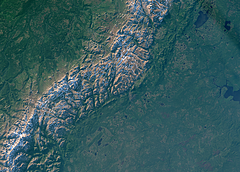
Summer evening view of the northern Ural mountains
Landsat 8 evening image of the northern Ural moundains in Russia at the border between Europe and Asia.
| view data | |
|---|---|
| Location: | 63° E, 66° N |
| Altitude: | 700 km |
| View Direction: | 0° |
| Camera Angle: | 0° |
| Available size: | up to 10415×7459 pixel |
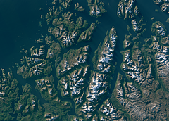
Summer evening view of northern Norway around Tromsø
Landsat 8 evening image of the coast of northern Norway around Tromsø.
| view data | |
|---|---|
| Location: | 19° E, 69.6° N |
| Altitude: | 700 km |
| View Direction: | 0° |
| Camera Angle: | 0° |
| Available size: | up to 10415×7459 pixel |
Blog news:
Todays featured image:

