Imagico.de
The Green Marble mosaic version 4

The Green Marble version 4 is a whole Earth image mosaic assembled from visual color satellite images. It is the fourth iteration of the Green Marble, the first truly global mosaic covering the full planet surface from the equator to the poles based on actual measured colors and with seamless coverage of the oceans. And it is the first truly cloud free mosaic with no residual clouds even in critical areas in the tropics. The Green Marble represents the surface color at the local vegetation maximum or snow/ice minimum at any part of the planet - hence the name. So in total it does not show any particular point of time but instead shows a generalized typical appearance of the earth surface.
The Green Marble version 4 provides both a data update and methodological improvements compared to version 3. It combines recent data of two different satellite systems (MODIS and Sentinel-3 OLCI). The image aggregation methods used, which have been improved successively over the previous versions, provide exceptionally low noise levels for both water and land depiction and an unsurpassed level of color consistency on a global scale.
Primary data source for land depiction is Sentinel-3 imagery from 2018 to 2023 at low latitudes, supplemented in parts with MODIS imagery from 2019 to 2023. At high latitudes Sentinel-3 and MODIS images are used in combination, for the Antarctic MODIS is the primary data source. Water area depiction is based on Sentinel-3 OLCI data from 2017-2023. Sea ice depiction is based on MODIS data.
In case you would like to read in more detail about this mosaic off-line a product description is available for download and offline reading as well.
Key properties
- Full coverage of the planet surface up to the poles and including the oceans based on locally measured colors.
- 100 percent cloud free.
- Based on Sentinel-3 and MODIS data from 2018-2023 for land areas and sea ice, Sentinel-3 water reflectance data for water areas, primarily from 2017-2023.
- 250m/300m resolution on both land and water, processed at 250m resolution.
- Depiction of the average vegetation maximum and snow/ice minimum appearance at any point on earth.
- Sea ice rendering showing either the typical summer extent or maximum ice free water.
- Available as linear surface reflectance values as well as tone mapped and either with shading as recorded, shading compensated or with customized relief shading.
Improvements of version 4
Compared to version 3 the version 4 mosaic offers the following improvements:
- Updated data basis for both land and water areas up to late 2023.
- Substantially widening the data basis, leading to a further reduction of noise levels in the final image. This in particular applies for the water depiction where the amount of data processed is about twice that of the previous version. In total more than 1 PB of satellite image data has been processed in the production of the Green Marble 4.
- Use of a 32 bit data format for reflectance values throughout the mosaicing process, which avoids accumulating rounding errors and ensures optimal quality in particular in dark areas.
- Various smaller improvement in the mosaicing process.
Product packaging

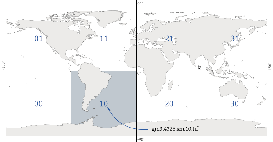
The Green Marble is produced in a spherical tiling scheme with different projections being used in different parts of the world for optimal quality everywhere.
The mosaic can be obtained in this original tiling but most users prefer a version in uniform equirectangular projection (EPSG:4326) because that is easier to handle. The default packaging of this is in 8 tiles each of a size of 43200×43200 pixel. This combines to a total mosaic size of 172800×86400 pixel. This tiling scheme is illustrated on the right.
Other variants like conversion into other projections or spatial subsets of the mosaic can be produced on request.
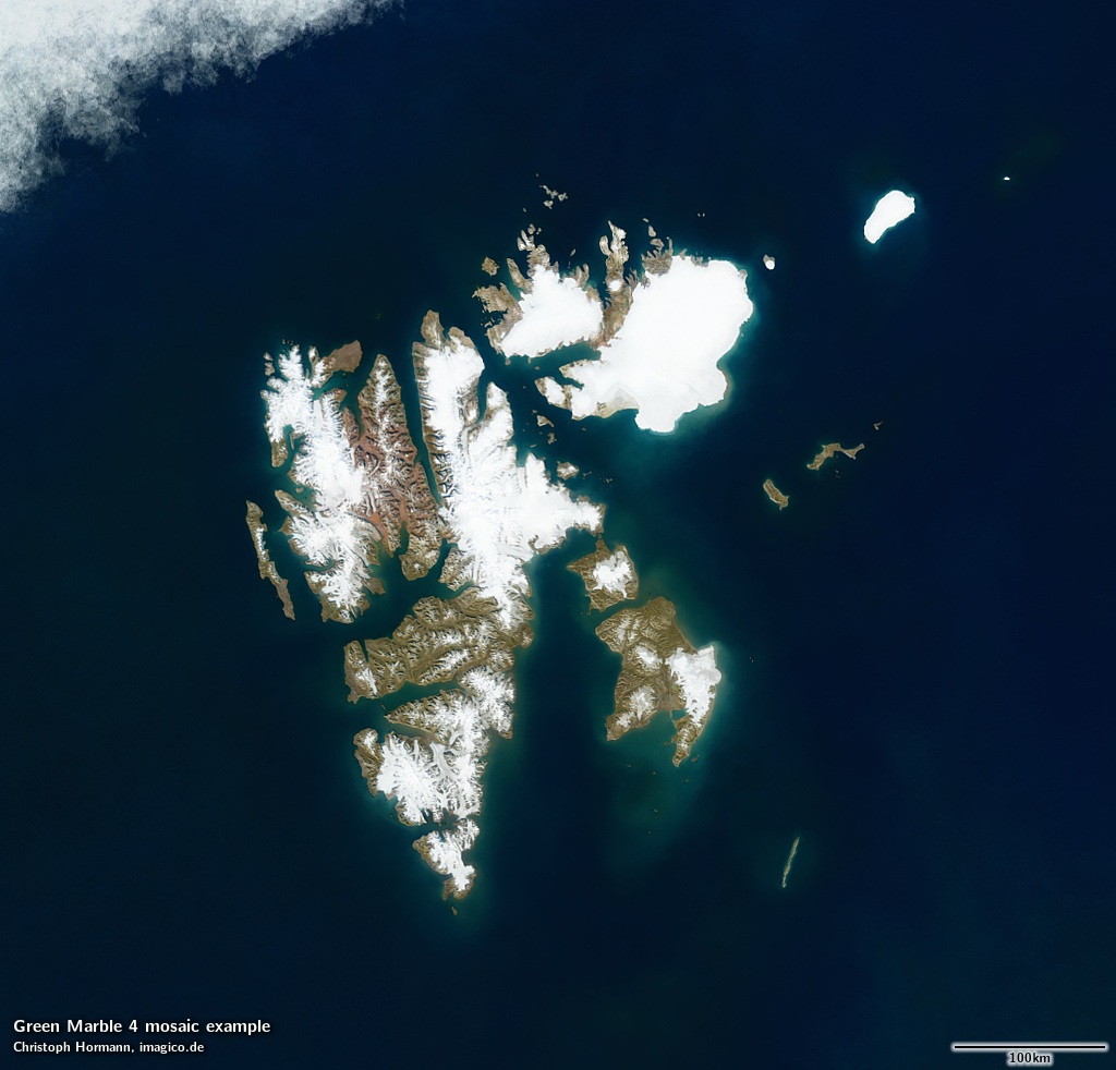
Sea ice rendering options
By default the Green Marble is available with a sea ice depiction in the polar regions showing an average summer ice extent from the years of source data coverage. Alternatively a mosaic variant can be provided that shows the maximum open water extent in the observation time span with only a minimum of sea ice. How these different variants look like in the polar regions can be seen below.


Tone mapping and shading options
The mosaic is produced and is available as linear surface reflectance. This can be rendered for display or print in different forms depending on the use case and individual style preferences. The standard tone mapping option offered is optimized for a well readable and appealing depiction of most of the earth surface in sRGB color space with a globally uniform mapping. For the Antarctic this tone mapping is not ideal and therefore a locally adjusted tone mapping option is used for rendering the Antarctic by default - with a smooth transit to the standard tone mapping further north. If a globally unified tone mapping is preferred that is available too of course.


The Green Marble is available with the original shading as recorded by the satellites. For Sentinel-3 this is a morning lighting, for the Antarctic the afternoon (west) illumination from the Aqua satellite is used. The mosaic is also available in a shading compensated version that is suitable for example to be used in production of 3d renderings or for combination with a custom relief shading.
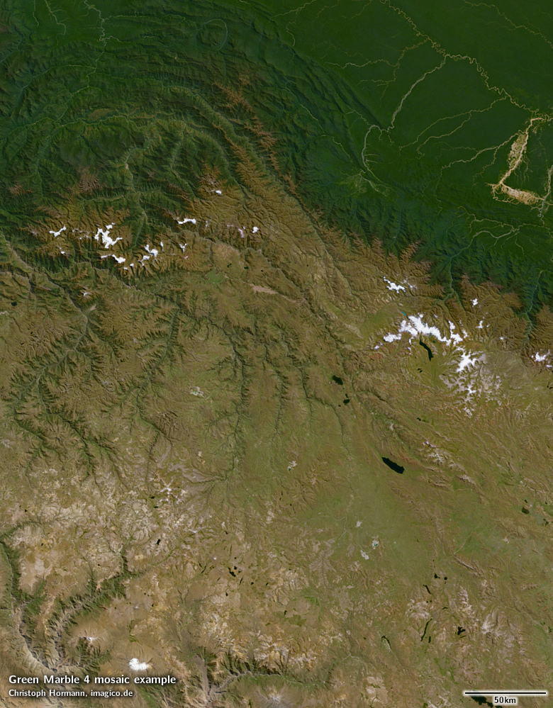


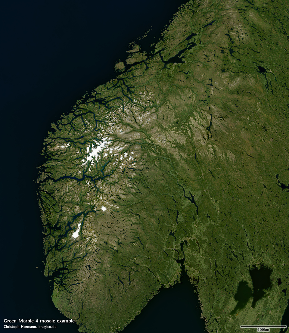
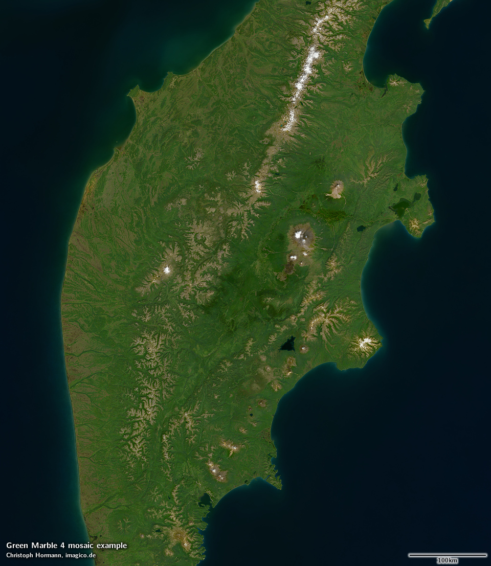
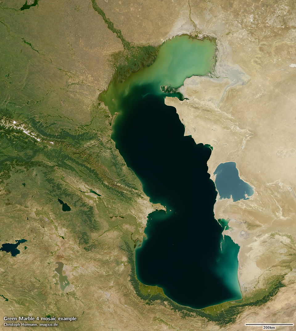
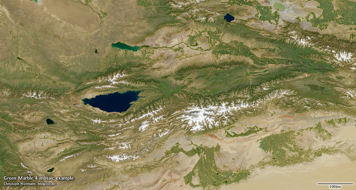
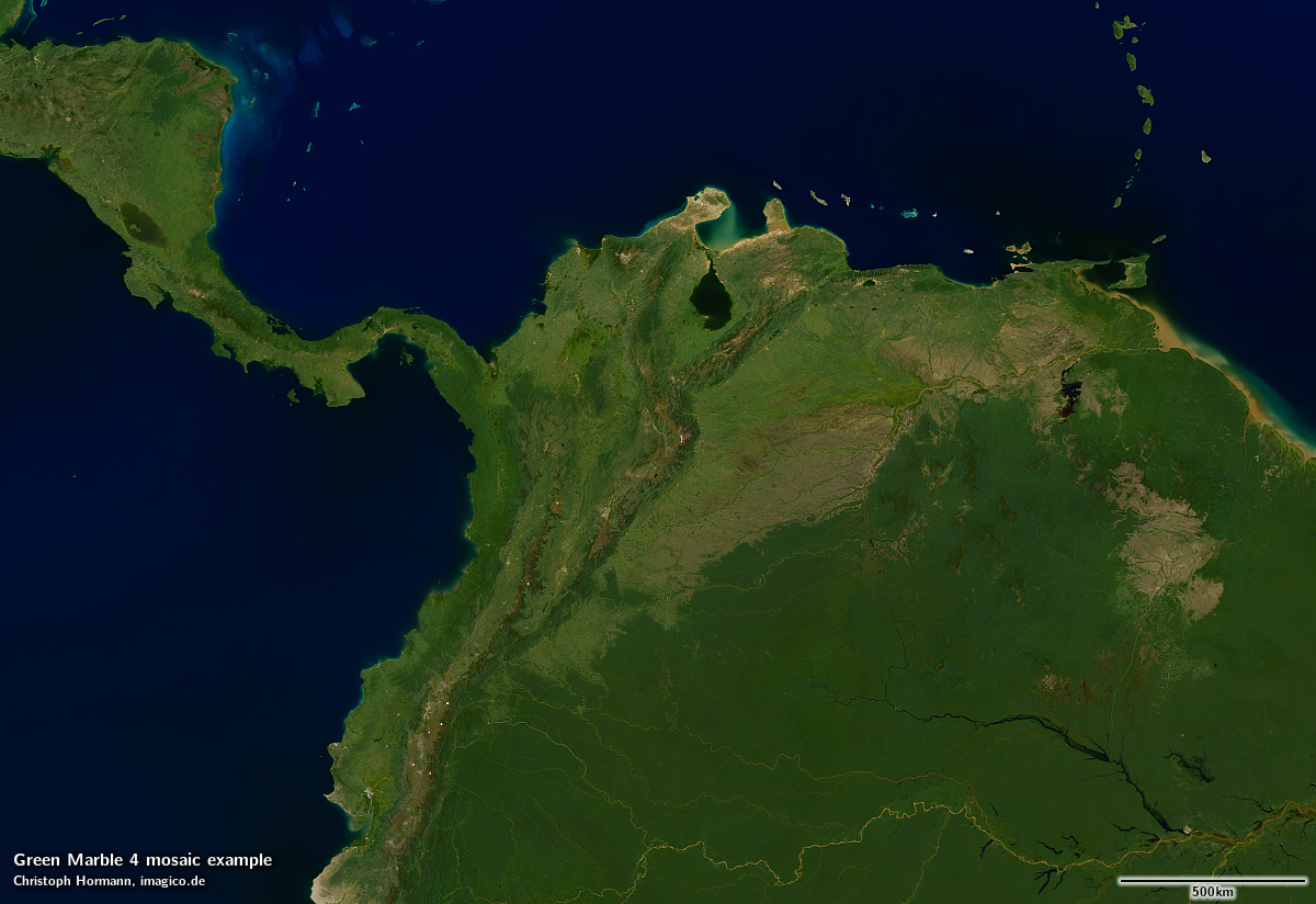
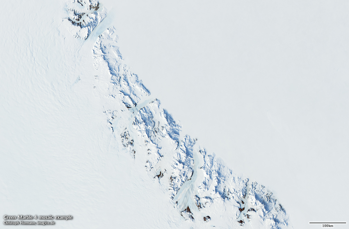
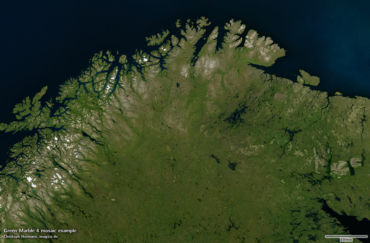
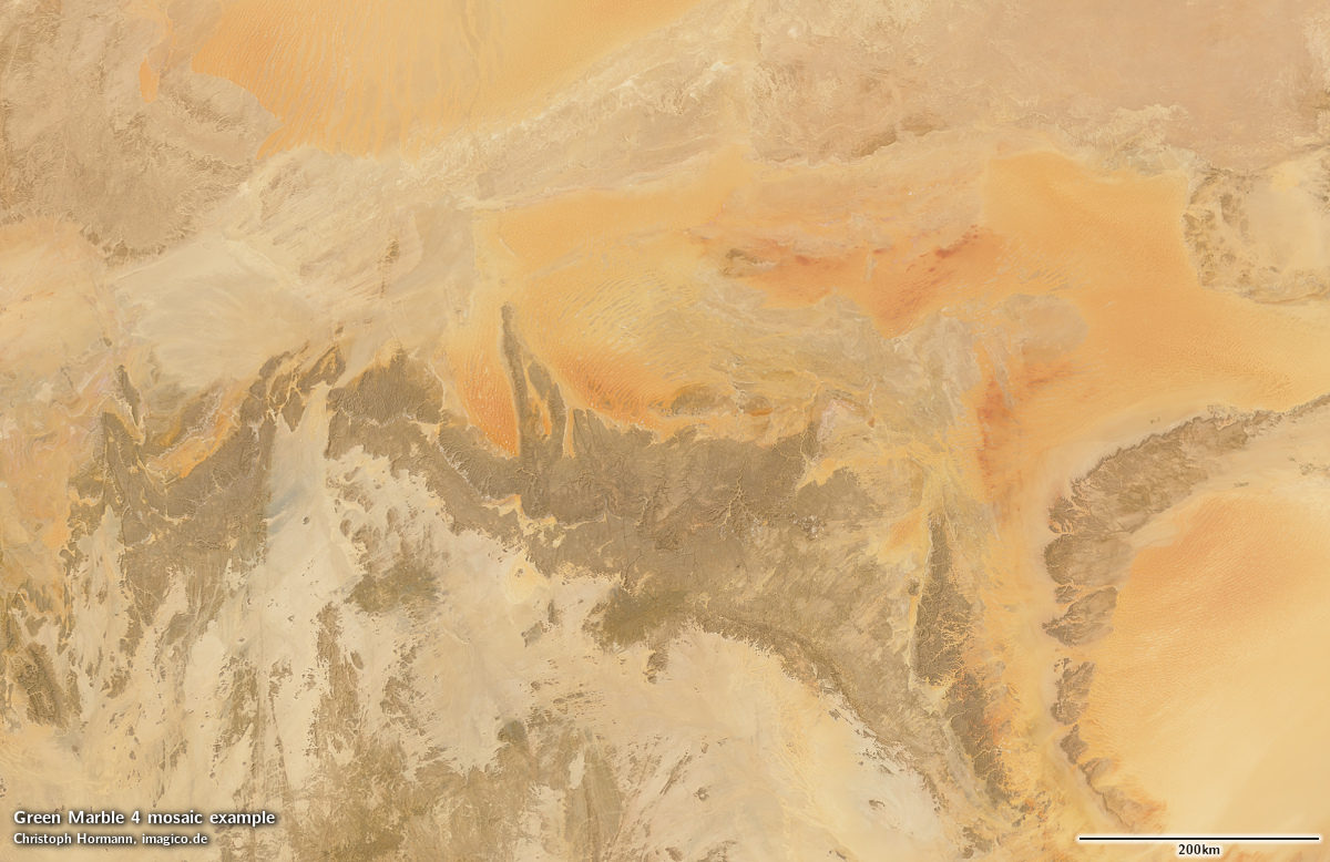
Sample gallery


Demo map
Here is a demonstration map in web mercator projection based on the Green Marble mosaic
A small version of the tone mapped Green Marble version 1 in plate carrée projection (EPSG:4326) is available for testing under CC-BY-SA license:
- gm_v10_4326_4800.zip (12 MB), usable under Creative Commons Share Alike license
For custom licensing you can obtain any other projection and size of course. For use in web maps i can also provide tile services.
Green Marble version 4 license inquiry
Blog news:
Todays featured image:
