On various occasions i have pointed out in the past how selectively internet map services these days feature different parts of our planet and how they often blatantly neglect many less popular (or less lucrative) areas. In the OSM images for mapping i try to compensate for this bias in a small way by giving some of those neglected areas a head start and a chance to get noticed. This is of course no guarantee to get any of these places properly represented in OpenStreetMap – this still requires sufficient interest and commitment from mappers.
Today i added a bunch of additional images – including a number of small islets which are almost fully missing from any map and satellite image services today. Here a table illustrating this – like the one in this post:
| Map | Hvalbakur | Clerke Rocks | Shag Rocks | Scott I. | Leskov I. |
|---|---|---|---|---|---|
| OSM | x | – | – | x | x |
| Google Maps | – | – | x | – | – |
| Google Satellite | x | – | – | – | – |
| Bing Maps | – | – | x | – | – |
| Bing Satellite | – | – | – | – | – |
| Mapbox Satellite | – | – | – | – | – |
Note the map data as far as it exists for these – both in OSM and elsewhere – is pretty inaccurate. Click on the column header to view the islet in question on the OSM images for mapping. When using these images to map in OSM – for the last four and as usual in the Southern Ocean – beware of icebergs.
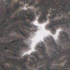
Other places i added are some mountains in southeastern Europe with cloudy or snow impaired images in the usual sources:
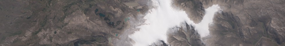
and the Quelccaya Ice Cap in Peru, the largest glacier in the tropics:
