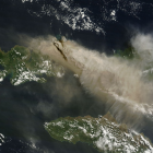
Yesterday the Sangeang Api in Indonesia started a major Eruption. Here a MODIS image from NASA worldview showing the large ash cloud which already extents over several hundered kilometers.
May 31, 2014
by chris
0 comments

May 31, 2014
by chris
0 comments
Yesterday the Sangeang Api in Indonesia started a major Eruption. Here a MODIS image from NASA worldview showing the large ash cloud which already extents over several hundered kilometers.
May 24, 2014
by chris
0 comments
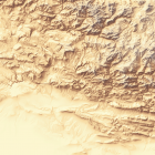
When updating the demonstration map recently I have made some changes to the standard style, most notably the bare ground color in the landcover style is now modulated based on climate with more reddish color in the warm desert regions … Continue reading
May 20, 2014
by chris
0 comments
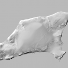
In addition to the mapping of the De Long Islands i produced an improved elevation model using the shape from shading techniques described earlier. Here is a shaded relief rendering of Bennett Island produced from this. This elevation data is … Continue reading

May 7, 2014
by chris
0 comments
I have featured the snow covered peak of Mount Kilimanjaro here before. There are now some nice new Landsat images from this years early rain season in the area (which is in April). The following two images extensive show fresh … Continue reading
May 7, 2014
by chris
0 comments
A new photo has been added to the Imagico photo log … Continue reading →
May 2, 2014
by chris
4 Comments
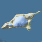
With the mappings of Franz Josef Land and Severnaya Zemlya there are a few smaller islands at the edge of the Arctic Ocean left that are generally poorly mapped, not only in OpenStreetMap but also elsewhere. Below is an overview … Continue reading
May 1, 2014
by chris
0 comments
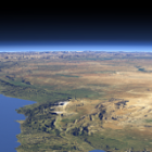
In the Eastern Mediterranean spring is the most colorful time of the year with fresh green in areas which receive winter rainfall and white snow in the higher mountains combined with the brown and red tones of the desert. The … Continue reading