I am happy to announce another update of my global satellite image mosaic – the Green Marble.
Version 4 of the Green Marble does not differ as much visually from its predecessors as version 2 and 3 since it continues to use the same principal data sources as before, that is Sentinel-3 OLCI data and MODIS images. It still represents a significant improvement in quality, in particular with substantially reduced noise levels in the water depiction. It updates and expands the source data for both the water and land depiction until late 2023.
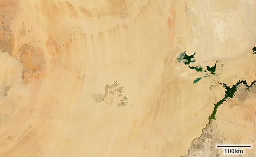
Since the range of dates of source images processed is quite large to ensure high quality results, short term changes on the Earth surface do not usually manifest strongly in the Green Marble. So the data update is primarily visible in the form of long terms trends, which are often relatively subtle. Here an example of irrigation farming in southern Egypt:


In addition to the data update there are also significant changes in data processing, fixing various smaller flaws and improving color uniformity. The biggest change is the move to a 32 bit per channel color representation in assembly of the mosaic. This avoids accumulation of rounding errors that has led to some color distortion in the previous versions on the water depiction and it avoids running into limitations of the standard 16 bit integer reflectance value representation in satellite image processing. I am going to discuss the background of this in a separate blog post.


Improvements of coastal water color depiction between Green Marble version 3 and 4 (large: GM 3, GM 4)
The Green Marble 4 global satellite image mosaic is available for licensing for use in your projects now. Have a look at the Green Marble product page for more information and sample images.
The demo maps with the Green Marble in different rendering variants are updated as well:


