
A map update has been put up on maps.imagico.de with an additional zoom level (zoom 7) for all map layers in mercator projection. In addition you can now activate an overlay with national boundaries and corresponding labels. Technically this is still somewhat experimental – generalization of the boundaries sometimes struggles with strange or broken mapping in OpenStreetMap and labeling also still has problems in some cases.


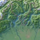
I also added a subtle rendering of builtup areas to the landcover layers – based on the techniques outlined here. Not everywhere OSM data is sufficient for a good rendering result though.
