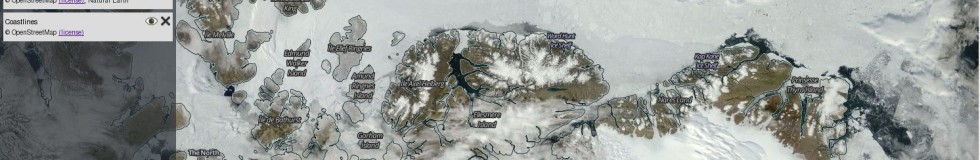
I just saw that the NASA has recently started fairly prominent use of of OpenStreetMap data in their Global Imagery Browse Services (GIBS). This is a neat service offering various near real time satellite data products for use in web maps or for other purposes. It is also the basis of their Worldview service where you can browse those images. Previously OSM coastlines have been used there in the Arctic polar projection. Now both coastlines and a labels layer are available in polar as well as normal view:

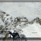
You can also used the GIBS service in your own applications – even having them as a background layer in JOSM is possible:

In case you want to try, the URLs are (date is probably arbitrary):
- Coastline: tms:http://map1.vis.earthdata.nasa.gov/wmts-webmerc/Coastlines/default/2014-08-20/GoogleMapsCompatible_Level9/{z}/{y}/{x}.png
- Labels: tms:http://map1.vis.earthdata.nasa.gov/wmts-webmerc/Reference_Labels/default/2014-08-20/GoogleMapsCompatible_Level9/{z}/{y}/{x}.png
Not sure how frequently they will update the data – that will remain to be seen. In any case a nice use of OSM-data. In case of the labels the different languages are strangely mixed though.