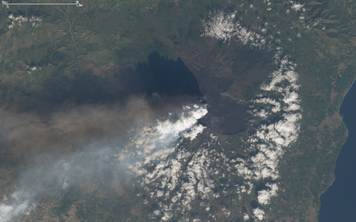
Two days ago the Etna, Europe’s largest active volcano, started erupting and there is a nice Landsat image available from that day:
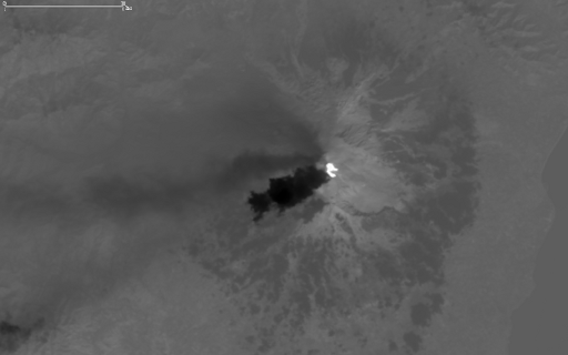
Interesting in case of volcanic activity is also the thermal infrared image which shows the hot areas and lava flows on the ground (which are not well visible in the daytime visual image) with high intensities and the plume that rapidly cools as it raises higher into the atmosphere with low intensities.
You can get the full Landsat scene from the USGS.


