
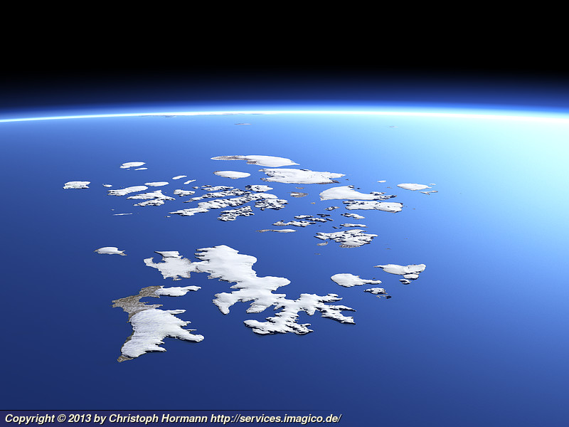
After the Franz Josef Land map I also worked on some new 3d views of the islands. The ones I previously made are based on early summer images from June with a lot of snow cover still in the images. The weather situation in the area is usually more stable in early summer so assembling images from that time of the year is easier. You can see the advantage of the new image mosaic by comparing this new view of the whole island group

with an earlier view from a similar perspective.
A few more closeup views of parts of the archipelago (the first two are on the Views of the Earth – click on the images to go there):


