On Wednesday this week the annual FOSSGIS conference is going to start in Passau and I look forward to be there and meet people and talk about free software and geodata. On Friday morning i am going to present a talk on free satellite images giving an introduction on what is available today in terms of open data satellite imagery for everyone to use.
As a teaser here a few images i am going to show as examples. These can be used under CC-BY-SA license, you can also print them in large if you want to. Be careful – these are fairly large image files with more than 6000 pixel in size.

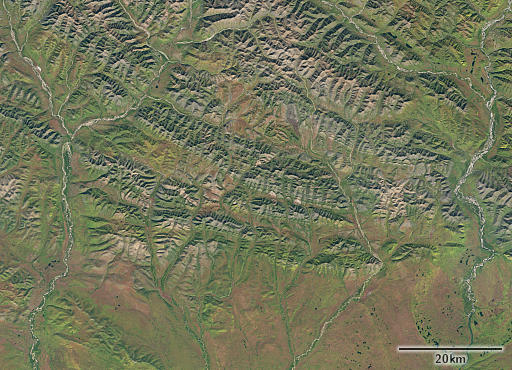
Verkhoyansk Range, eastern Russia 07-09-2016 by Landsat 8 – full size image

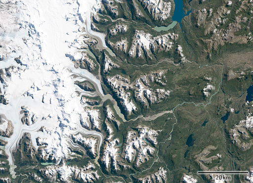
Patagonia, Chile 15-03-2017 by Landsat 8 – full size image

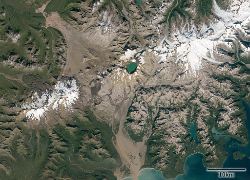
Mt. Katmai/Novarupta, Alaska 13-09-2016 by Sentinel-2 – full size image
As a bit of a side blow here some links to what the usual suspects offer in these areas – Patagonia, Siberia, Alaska
Those who want to come by spontaneously can do so – Entry is free for those active in Open Source software and free geodata.
Update: Video of the talk is now available on youtube, a PDF of the slides will also be linked from the program later.


March 21, 2017 at 22:50
By any chance, will the talk be in English and recorded/streamed? I would love to see it!
March 21, 2017 at 22:58
No, talk will be in German but there will be recordings and slides will be made available and you can machine-translate them which should give you an idea about what i talk about.