Imagico.de
Satellite image products
One type of visualization I offer in addition to 3d earth views are satellite image mosaics. These images are designed to give a realistic and consistent impression of the earth surface color without clouds and other atmosphere effects. They can be used for interactive maps and applications as well as in print.
Most of the images offered here are the most up-to-date and highest quality products currently available regarding consistency of colors and uniformity in rendering with the respective coverage and resolution.
In addition to the images offered here some local image assemblies from specific dates can also be found in the general image catalog. Both these and the images here can also be produced on demand according to customer specifications. Contact me for details regarding this.
The Green Marble mosaic version 4
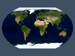
The Green Marble is a global cloud free true color image of the earth surface depicting the surface color at the time of vegetation maximum.
Find out more about the Green Marble
For reference the Green Marble version 1
For reference the Green Marble version 2
For reference the Green Marble version 2.1
The Musaicum EU-plus satellite image mosaic
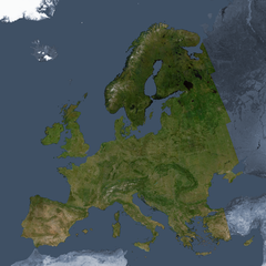
The Musaicum EU-plus satellite image mosaic is a regional visible color satellite image mosaic of the Continental European Union and adjacent areas with a ground resolution of 10m.
Find out more about the Musaicum EU-plus satellite image mosaic
The Musaicum West Asia satellite image mosaic
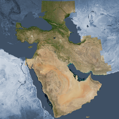
The Musaicum West Asia satellite image mosaic is a regional visible color satellite image mosaic of West Asia and adjacent areas with a ground resolution of 10m.
Find out more about the Musaicum West Asia satellite image mosaic
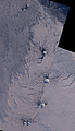
The Comprehensive Optical Mosaic of the Antarctic (COMA)
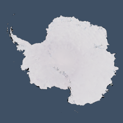
The Comprehensive Optical Mosaic of the Antarctic (COMA) is a cloud free mosaic of the Antarctic, combining different satellite image sources, with a base resolution of 15m for most of its coverage area.
Find out more about the Comprehensive Optical Mosaic of the Antarctic (COMA)
The Sentinel-2 mosaic of New Zealand
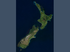
The Sentinel-2 mosaic of New Zealand is a cloud free mosaic created from Sentinel-2 data, it shows the islands of New Zealand based on data from 2015 to 2017 in 10m resolution.
The South Georgia mosaics
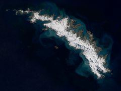
For South Georgia you can get two different mosaics:
- one primarily based on Landsat 8 images in 15m resolution - see here for details.
- the other primarily based on Sentinel-2 images in 10m resolution - see here for details.
The Sentinel-2 mosaic of the Falkland Islands
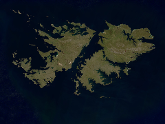
The Sentinel-2 mosaic of the Falkland Islands shows the Falkland Islands in the Southwest Atlantik Ocean based on Sentinel-2 data from 2015 to 2018 in 10m resolution.
Landsat/Sentinel-2 mosaics of the other Subantarctic Islands
I offer also mosaics of the other Subantarctic Islands based on Sentinel-2 and Landsat data
Sentinel-2 mosaics of the Balleny Islands
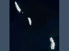
The Sentinel-2 mosaic of the Balleny Islands shows the Balleny Islands off the Antarctic coast based on recent Sentinel-2 summer images.
The Landsat mosaic of Germany and the Alps
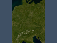
The Landsat mosaic of Germany and the Alps is an up-to-date cloud free image assembly in 15m resolution covering Germany and the Alps and representing the earth surface color.
The Landsat mosaic of Greenland
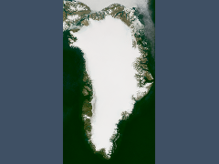
The Landsat mosaic of Greenland shows Greenland and the adjacent parts of northern Canada free of clouds in 15m resolution based on up-to-date summer images.
The Landsat mosaic of Scandinavia
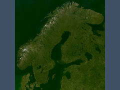
The Landsat mosaic of Scandinavia shows Scandinavia, the Baltic Sea and surrounding areas free of clouds in 15m resolution based on up-to-date summer images in realistic colors.
The Landsat mosaic of the Antarctic peninsula
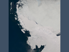
The Landsat mosaic of the Antarctic peninsula depicts the Antarctic peninsula in 15m resolution based on up-to-date images and free of clouds.
The Sentinel-2 mosaic of southern Africa
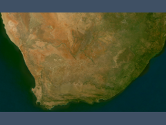
The Sentinel-2 mosaic of southern Africa is my first cloud free mosaic created from Sentinel-2 data, it shows the southmost part of Africa based on data from the 2015/2016 summer in 10m resolution.
The Landsat mosaic of Cuba
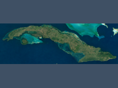
The Landsat mosaic of Cuba shows the island of Cuba in 15m resolution based on up-to-date Landsat images without clouds.
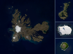
The Landsat mosaic of Iceland
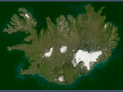
The Landsat mosaic of Iceland shows the island of Iceland in 15m resolution based on up-to-date Landsat and Sentinel-2 images without clouds.
The Svalbard mosaics
For Svalbard you can get two different mosaics:
- one primarily based on Landsat 8 images in 15m resolution - see here for details.
- the other primarily based on Sentinel-2 images in 10m resolution - see here for details.
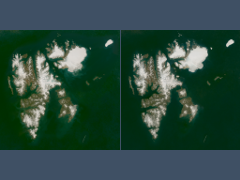
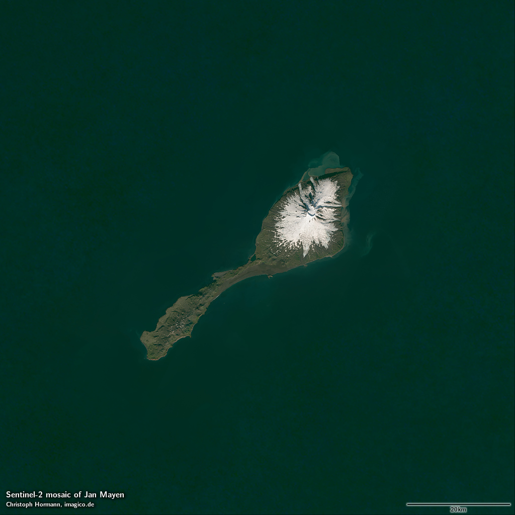
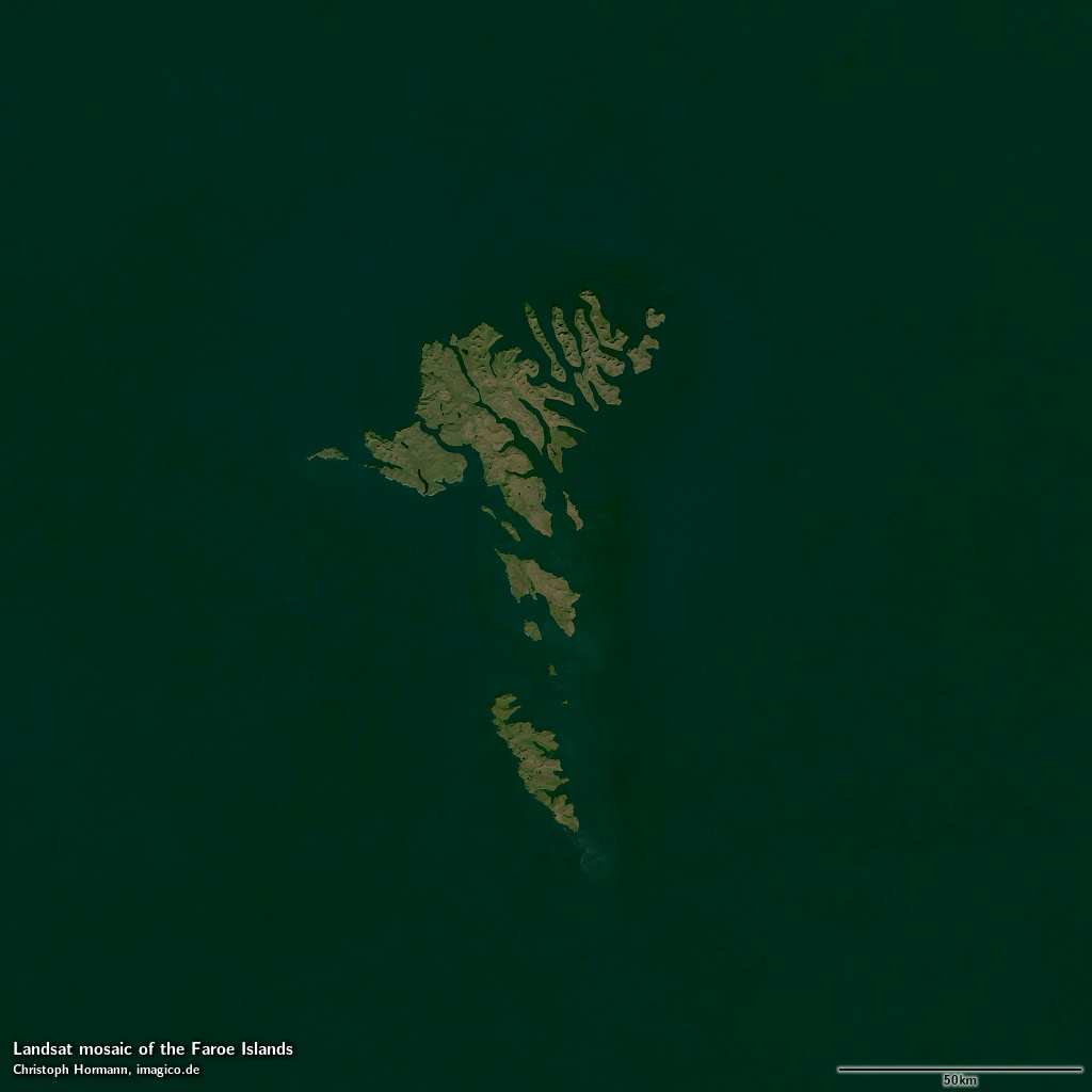
Further local mosaics
Here a few more cloud free Landsat and Sentinel-2 mosaics for select smaller areas.
| mosaic | data source | preview |
|---|---|---|
| Jan Mayen | Sentinel-2 | show |
| Faroe Islands | Landsat/Sentinel-2 | show |
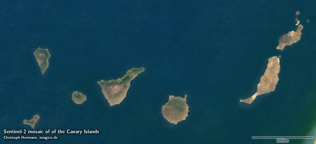
| Canary Islands | Sentinel-2 | show |
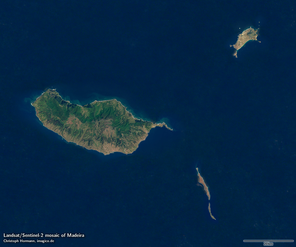
| Madeira | Landsat/Sentinel-2 | show |
Blog news:
Todays featured image: